
The ORNL DAAC recently released a new Active Sensing of CO2 Emissions over Nights, Days, and Seasons (ASCENDS) Airborne Campaign dataset by Abshire, J.B. (2023):
ASCENDS: Airborne CO2 LAS Retrieval, Indianapolis, IN, USA, 2014
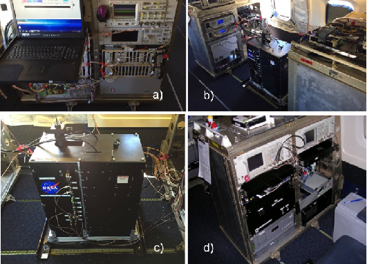
This dataset provides in situ airborne measurements of atmospheric carbon dioxide (CO2) over Indianapolis, Indiana (IN) on September 3, 2014 during the morning commuter period with heavy traffic emissions. Stationary source emissions are also included. The observed CO2 plume downwind of the urban area, along with the prevailing wind speed and direction, enabled estimations of emission rates. CO2 was measured with an airborne CO2 Laser Absorption Spectrometer (JPL CO2LAS) developed at NASA's Jet Propulsion Laboratory (JPL) to demonstrate the airborne Integrated Path Differential-Absorption (IPDA) lidar technique as a stepping stone to a capability for global measurements of CO2 concentrations from space. The CO2LAS measures the weighted, column averaged carbon dioxide between the aircraft and the ground using a continuous-wave heterodyne technique. The instrument operates at a 2.05 micron wavelength optimized for enhancing sensitivity to boundary layer carbon dioxide. Measurements were taken onboard a DC-8 aircraft during this Active Sensing of CO2 Emissions over Nights, Days and Seasons (ASCENDS) airborne deployment. The data are provided in HDF-5 format.
The ASCENDS Airborne Campaign was a multi-year effort conducted between 2011 and 2017 to support the science definition study of the Active Sensing of CO2 Emissions over Nights, Days, and Seasons (ASCENDS) mission, whose objective was to make global atmospheric column carbon dioxide (CO2) measurements without a seasonal, latitudinal, or diurnal bias. Through the airborne campaign, several NASA lidar teams made substantial advances in developing suitable lidar techniques and instruments, demonstrating lidar capabilities from aircraft, improving the understanding of the characteristics needed in the measurements, and advancing the technologies needed for the space lidar. The 2017 ASCENDS airborne deployment was flown on the NASA DC-8 in late July and early August 2017 and was planned in coordination with the NASA Arctic-Boreal Vulnerability Experiment (ABoVE) 2017 field campaign.
Additional data from ASCENDS and other relevant links can be found on the ORNL DAAC's ASCENDS Project Page.
Citation: Abshire, J.B. 2023. ASCENDS: Airborne CO2 LAS Retrieval, Indianapolis, IN, USA, 2014. ORNL DAAC, Oak Ridge, Tennessee, USA. https://doi.org/10.3334/ORNLDAAC/2116