
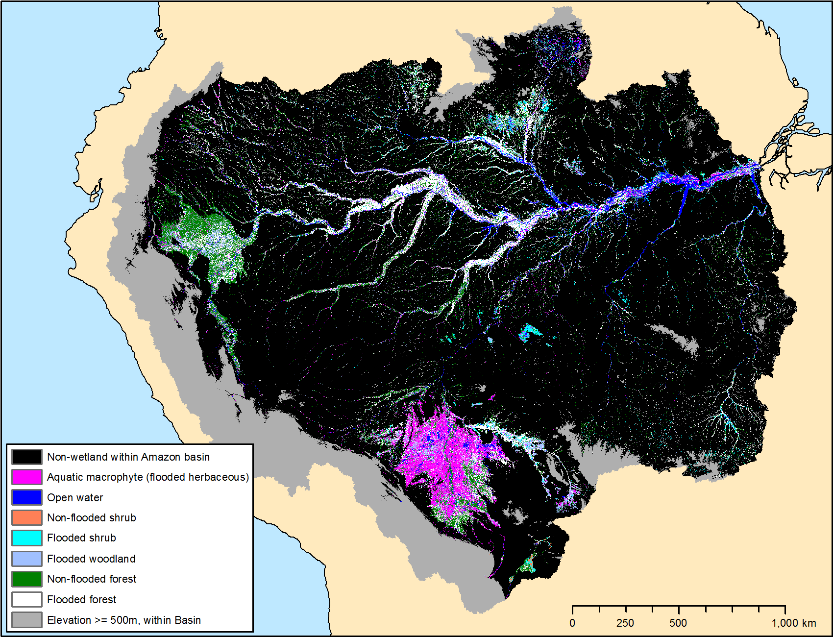
LBA-ECO LC-07 Wetland Extent, Vegetation, and Inundation: Lowland Amazon Basin
This data set provides a map of wetland extent, vegetation type, and dual-season flooding state of the entire lowland Amazon basin. This data was derived from the Global Rain Forest Mapping Project (GRFM) Amazon mosaics acquired during Oct.-Nov. 1995 and May-June 1996, corresponding to the low-flood and high-flood seasons for much of the central Amazon.
Data Acknowledgements
Data authors: Hess, L.L., J.M. Melack, A.G. Affonso, C.C.F. Barbosa, M. Gastil-Buhl, and E.M.L.M. Novo.
Data set DOI: 10.3334/ORNLDAAC/1284
Data center: ORNL DAAC
Sponsor: NASA EOSDIS
.")