
CMS: GLAS LiDAR-derived Global Estimates of Forest Canopy Height, 2004-2008
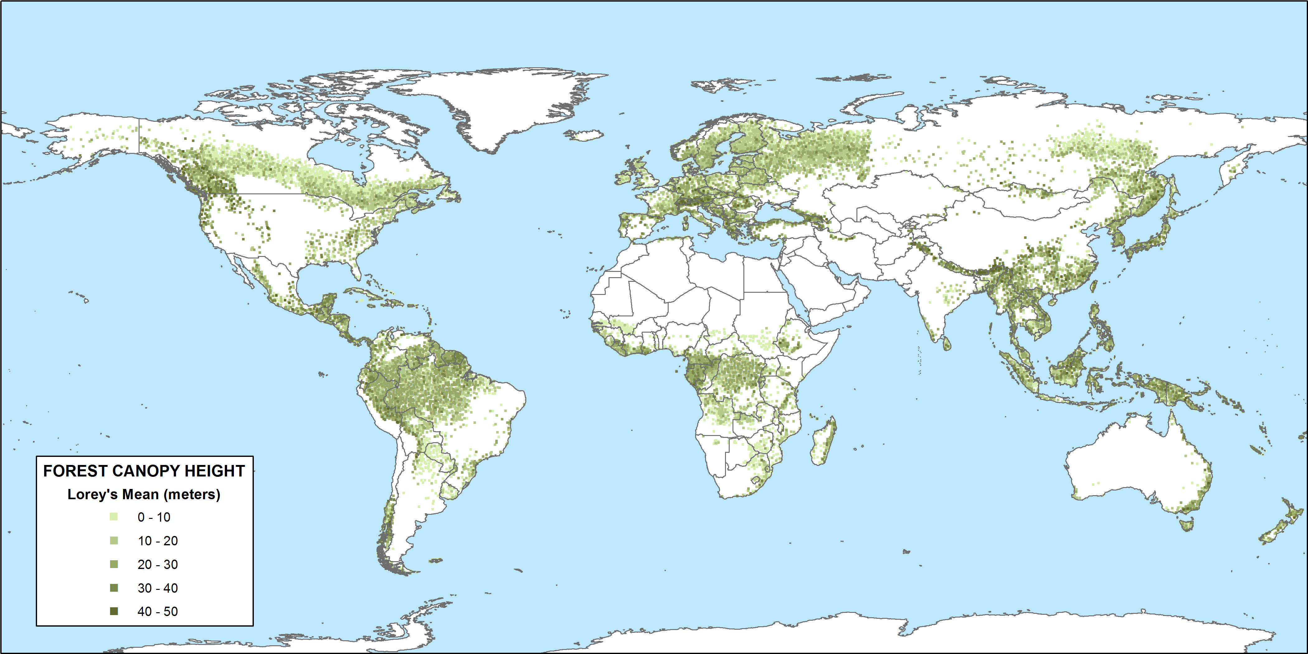
This data set provides estimates of forest canopy height derived from the Geoscience Laser Altimeter System (GLAS) LiDAR instrument that was aboard the NASA Ice, Cloud, and land Elevation (ICESat) satellite. A global GLAS waveform data set (n=12,336,553) from collection periods between October 2004 and March 2008 was processed to obtain canopy height estimates. Estimates of GLAS maximum canopy height and crown-area-weighted Lorey's height are provided for 18,578 statistically-selected globally distributed forested sites in a point shapefile. Country is included as a site attribute. Also provided is the average canopy height for the forested area of each country, plus the number of GLAS data footprints (shots), number of selected sample sites, and estimates of the variance for each country.
Data Acknowledgements
Healey, S.P., M.W. Hernandez, D.P. Edwards, M.A. Lefsky, E. Freeman, P.L. Patterson, E.J. Lindquist, and A.J. Lister.
Data Set DOI: http://dx.doi.org/10.3334/ORNLDAAC/1271
Data center: ORNL DAAC
Sponsor: NASA EOSDIS
).")