
Geocoded digital videography data from 1999 provides a high resolution historical baseline for studies of land cover, deforestation, and wetland inundation in the Amazon.
LBA-ECO LC-07 Validation Overflight for Amazon Mosaics, Video, 1999
LBA-ECO LC-07 Validation Overflight for Amazon Mosaics, Raster, 1999
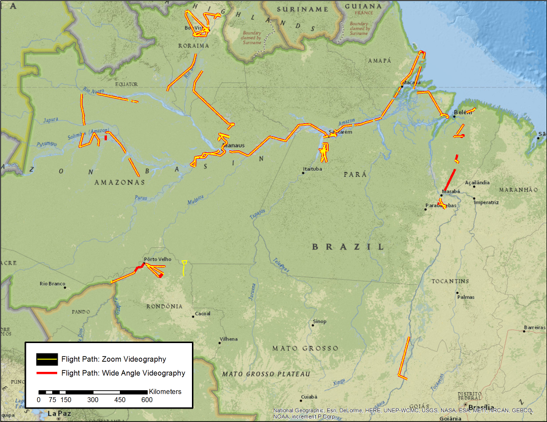
Two LBA-ECO data sets, now available from the ORNL DAAC, present georeferenced digital video clips and high-resolution geocoded mosaics derived from Validation Overflight for Amazon Mosaics (VOAM) aerial video surveys as part of the Large-Scale Biosphere-Atmosphere Experiment in the Amazon. The VOAM flights were carried out in the wet-season (June) 1999 in the Brazilian Amazon to provide ground verification for mapping of wetland cover with the Global Rain Forest Mapping (GRFM) Project JERS-1 (Japanese Earth Remote Sensing Satellite) mosaics. The VOAM99 surveys circumscribed the Brazilian Amazon, documenting ground conditions at resolutions on the order of 1 m (wide-angle format) and 10 cm (zoom format) for wetlands, forests, savannas, and human-impacted areas. These data were part of a multi-scale analysis of inundation and wetland vegetation using remote sensing to address important aspects of the regional carbon dynamics of the Amazon basin.
LBA was an international research initiative under the leadership of Brazil. The project focused on the climatological, ecological, biogeochemical, and hydrological functions of Amazonia; the impact of land use change on these functions; and the interactions between Amazonia and the Earth system. The LBA-ECO component, which was funded by NASA, focused on the question: "How do tropical forest conversion, regrowth, and selective logging influence carbon storage, nutrient dynamics, trace gas fluxes, and the prospect for sustainable land use in Amazonia?"
To view complete documentation and access the data, visit the data set web pages at http://daac.ornl.gov/cgi-bin/dsviewer.pl?ds_id=1272 and http://daac.ornl.gov/cgi-bin/dsviewer.pl?ds_id=1274
Data Acknowledgements:
Data authors: Hess L.L., J.M. Melack, E.M.L.M. Novo, C.C.F. Barbosa, and M. Gastil-Buhl.
Data center: ORNL DAAC (http://daac.ornl.gov)
Sponsor: NASA EOSDIS (http://earthdata.nasa.gov)
Data Set DOIs: 10.3334/ORNLDAAC/1272 and 10.3334/ORNLDAAC/1274
