The ORNL DAAC recently released the following two new MASTER (MODIS/ASTER) Airborne Simulator datasets:
MASTER (MODIS-ASTER) Airborne Simulator Campaign, SARP, California, USA, 2016
This dataset includes Level 1B (L1B) and Level 2 (L2) data products from the MODIS/ASTER Airborne Simulator (MASTER) instrument collected and developed by the Student Airborne Research Program (SARP). The raw spectral data were collected from flights flown on 2016-06-17 over the region impacted by the Sherpa Fire (2016-06-15) near Bakersfield and Santa Barbara, California. Data products include L1B multispectral imagery in 50 bands covering wavelengths of 0.460 to 12.879 micrometers at approximately 19 to 50 meter resolution. Derived L2 products include estimates of emissivity in 5 bands and land surface temperature.
SARP is an eight-week summer program for junior and senior undergraduate students to acquire hands-on research experience in all aspects of a scientific campaign using NASA's DC-8 or P-3B airborne science laboratories.
MASTER (MODIS-ASTER) Airborne Simulator Campaign, California and Nevada, USA, 2016
This dataset includes Level 1B (L1B) and Level 2 (L2) data products from the MODIS/ASTER Airborne Simulator (MASTER) instrument. The raw spectral reflectance data were collected as part of the Hyperspectral Infrared Imager (HyspIRI) mission's preparatory airborne campaign during five flights aboard a NASA ER-2 aircraft over California and Nevada, U.S., from 2016-06-09 to 2016-06-22. Data products include L1B multispectral imagery with 50 bands covering wavelengths of 0.460 to 12.879 micrometers at approximately 50 meter resolution. Derived L2 data products include estimates of emissivity in 5 bands and land surface temperature.
This campaign demonstrated research uniquely enabled by HyspIRI-like data, taking advantage of the full suite of MASTER thermal infrared bands as well as the contiguous spectroscopic measurements of the AVIRIS (also flown in the HyspIRI campaign).
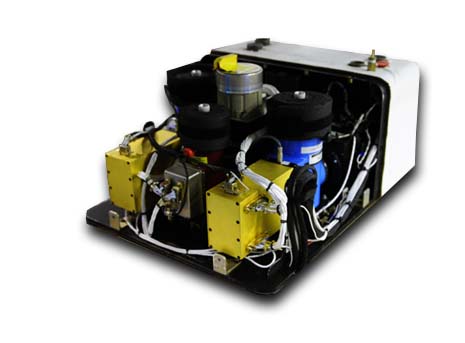
The MODIS/ASTER Airborne Simulator (MASTER) is a scanning spectrometer which flies on a variety of multi-altitude research aircraft and provides data similar to the Moderate Resolution Imaging Spectroradiometer (MODIS) and the Advanced Spaceborne Thermal Emission and Reflection Radiometer (ASTER). MASTER first flew in 1998 and has ongoing deployments as a Facility Instrument in the NASA Airborne Science Program (ASP).
Additional data from MASTER and other relevant links can be found on the ORNL DAAC's MASTER project page.
Citations:
Green, R.O., S.J. Hook, and D.A. Roberts. 2021. MASTER (MODIS-ASTER) Airborne Simulator Campaign, SARP, California, USA, 2016. ORNL DAAC, Oak Ridge, Tennessee, USA. https://doi.org/10.3334/ORNLDAAC/1912
Hook, S.J., and R.O. Green. 2021. MASTER (MODIS-ASTER) Airborne Simulator Campaign, California and Nevada, USA, 2016. ORNL DAAC, Oak Ridge, Tennessee, USA. https://doi.org/10.3334/ORNLDAAC/1913

