
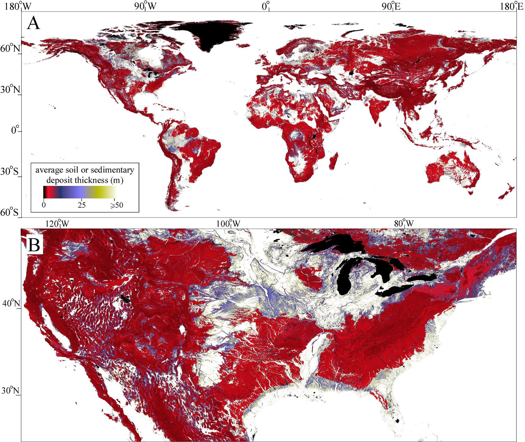
Global 1-km Gridded Thickness of Soil, Regolith, and Sedimentary Deposit Layers.
This data set provides high-resolution estimates of the thickness of the permeable layers above bedrock (soil, regolith, and sedimentary deposits) within a global 30-arcsecond (~1-km) grid using the best available data for topography, climate, and geology as input. These data are modeled to represent estimated thicknesses by landform type for the geological present.
Data Acknowledgements
Data authors: Pelletier, J.D., P.D. Broxton, P. Hazenberg, X. Zeng, P.A. Troch, G. Niu, Z.C. Williams, M.A. Brunke, and D. Gochis.
Data Set DOI: http://dx.doi.org/10.3334/ORNLDAAC/1304
Data center: ORNL DAAC
Sponsor: NASA EOSDIS
 Global, (B) subset of conterminous U.S.")