Land Cover and Land Use Classification for the State of New Hampshire, 1996-2001
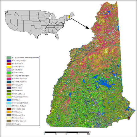
The New Hampshire Geographically Referenced Analysis and Information Transfer System (GRANIT) land cover data set provides a land cover and land use product at 30-m resolution with 23 individual classes across the state. The classification is based largely on the analysis of 12 Landsat Thematic Mapper (TM and ETM+) images. Over 1,400 new classification training site data points were collected to supplement 1,200 archived sites from previous projects. The classification represents a snapshot in time from 1996 to 2001. This time range spans the dates of the most recent acquisitions of a TM scene for each region of the state and the dates of the most recent field data collection. This data set was originally part of the EOS-EarthData collection at the University of New Hampshire.
Data Acknowledgements
Data authors: Justice, D., A.K. Deely, and F. Rubin.
Data Set DOI: http://dx.doi.org/10.3334/ORNLDAAC/1305
Data center: ORNL DAAC
Sponsor: NASA EOSDIS