
AirMOSS: L4 Modeled Volumetric Root Zone Soil Moisture, 2012-2015
This data set provides hourly gridded soil moisture estimates derived from hydrologic modeling at nine AirMOSS sites across North America. The AirMOSS L4 RZSM product represents a temporal interpolation of intermittent AirMOSS L2/3 RZSM retrievals into a temporally-continuous, multi-layer, hourly soil moisture product. The L4 RZSM data have the same spatial resolution (3-arcsecs or ~100 m), and the same temporal coverage (generally Fall 2012 through Fall 2015), as the underlying L2/3 RZSM data. The L4 RZSM data were produced by the integration of the Level 2/3 product and other ancillary information into the Penn State Integrated Hydrologic Model (PIHM). Many key applications for AirMOSS data products, including the calculation of net ecosystem exchange (NEE), require temporally continuous RZSM estimates such as those provided here.
Data Acknowledgements
Data Authors: Crow, W.T., S. Milak, and R.H. Reichle.
Data Set DOI: http://dx.doi.org/10.3334/ORNLDAAC/1421
Data center: ORNL DAAC
Sponsor: NASA EOSDIS
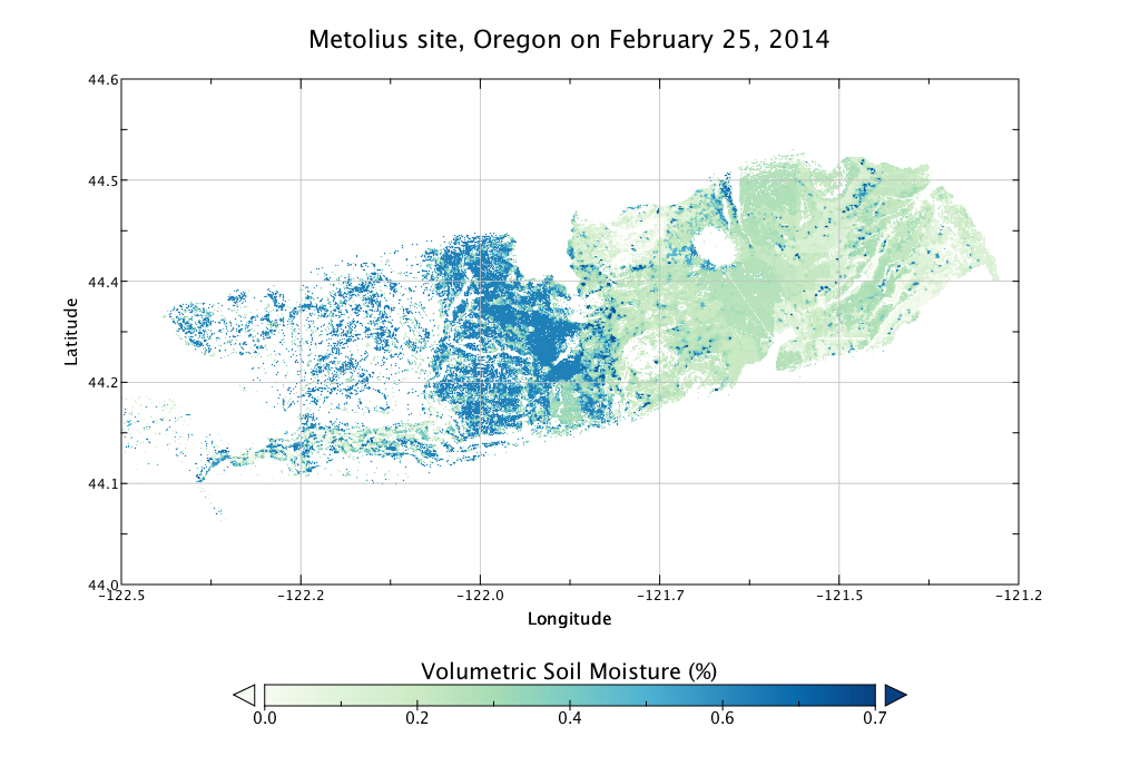
 soil moisture at the Metolius site, Oregon, at midnight on Feb. 25, 2014.")