
NACP NAFD Project: Forest Disturbance History from Landsat, 1986-2010
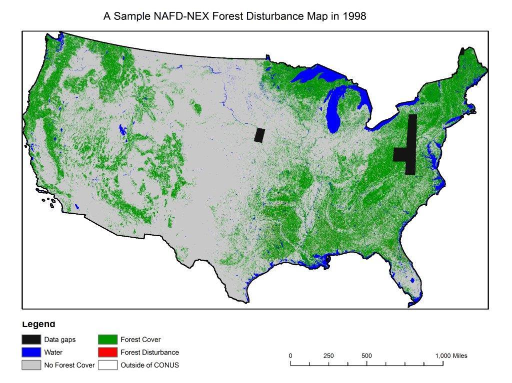
The North American Forest Dynamics (NAFD) product provided in this data set consists of 25 annual and two time-integrated forest disturbance maps for the conterminous United States (CONUS) derived from Landsat images for the period 1986-2010. Each annual map has classified pixels showing water, no forest cover, forest cover, no data available (data gaps) in the present year, and forest disturbances that occurred in that year. The time-integrated maps are similarly classified, but over the entire 1986-2010 period with the first and last forest disturbance years identified and provided as separate maps.
Data Acknowledgements
Data authors: Goward, S.N., C. Huang, F. Zhao, K. Schleeweis, K. Rishmawi, M. Lindsey, J.L. Dungan, and A. Michaelis.
Data Set DOI: http://dx.doi.org/10.3334/ORNLDAAC/1290
Data center: ORNL DAAC
Sponsor: NASA EOSDIS
")