
This data set provides classified maps of peatland at 12.5-m resolution and Burn Severity Index (BSI) maps at 30-m resolution for four wildfire areas in northern Alberta, Canada.
NACP Peatland Landcover Type and Wildfire Burn Severity Maps, Alberta, Canada
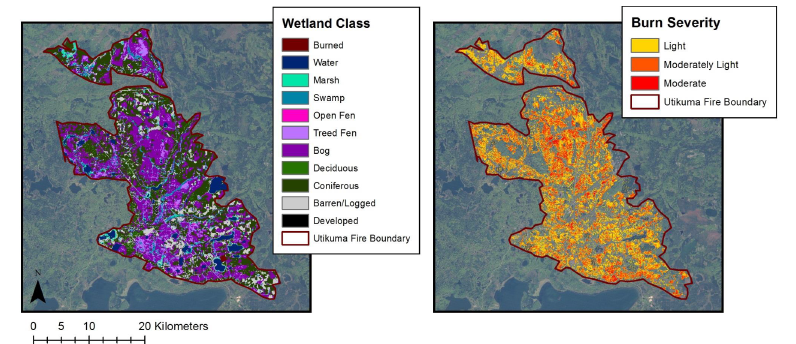
Peatland was classified at each wildfire site, based on a pre-burn 2007 multi-date, multi-sensor fusion (Optical-IR, C-band and L-band SAR) approach. Burn severity was measured in the field using the Burn Severity Index (BSI). The field data of ground consumption were correlated with Landsat pre- and post-burn imagery to develop multivariate models for calculating burn severity. These models were used to generate the Burn Severity Maps at 30-m resolution (percent unburned moss, and the burn severity index (BSI)).
To view complete documentation and access the data, visit the data set web pages at http://daac.ornl.gov/cgi-bin/dsviewer.pl?ds_id=1283
Data Acknowledgements:
Data authors: Bourgeau-Chavez, L.L., S. Endres, E. Banda, R. Powell, M.R. Turetsky, B. Benscoter, and E.S Kasischke.
Data center: ORNL DAAC (http://daac.ornl.gov)
Sponsor: NASA EOSDIS (http://earthdata.nasa.gov)
Data Set DOI: 10.3334/ORNLDAAC/1283
