
Russian Boreal Forest Disturbance Maps Derived from Landsat Imagery, 1984-2000
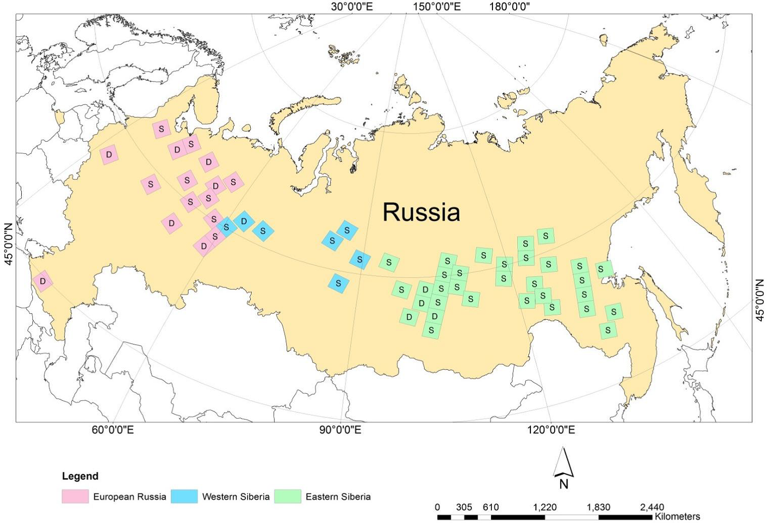
This data set provides Boreal forest disturbance maps at 30-m resolution for 55 selected sites across Northern Eurasia within the Russian Federation. Disturbance events were derived from selected high-quality multi-year time series of Landsat Thematic Mapper and Enhanced Thematic Mapper Plus images (stacks) over the 1984 to 2000 time period. Forest pixels were classified by year of latest disturbance or as undisturbed.
Data Acknowledgements
Data authors: Chen, D., T.V. Loboda, S. Channan, and A. Hoffman-Hall.
Data Set DOI: http://dx.doi.org/10.3334/ORNLDAAC/1294
Data center: ORNL DAAC
Sponsor: NASA EOSDIS
