
ABoVE: Surface Water Extent, Boreal and Tundra Regions, North America, 1991-2011
This data set provides the location and extent of surface water (open water not including vegetated wetlands) for the entire Boreal and Tundra regions of North America for three epochs, centered on 1991, 2001, and 2011. Each of the products were generated with at least three years of ice-free Landsat imagery. The data are at 30-m resolution and were derived from time series of Landsat 4 and 5 Thematic Mapper (TM) data and Landsat 7 Enhanced Thematic Mapper (ETM+) covering all of Alaska and all provinces of Canada. The overall goal was to generate a map of the nominal extent of water for a given epoch, where nominal is neither the maximum nor the minimum but rather a representative extent for that time period.
Data Acknowledgements
Data authors: Carroll, M.L., M.R. Wooten, C. Dimiceli, R.A. Sohlberg, and J.R.G. Townshend.
Data Set DOI: http://dx.doi.org/10.3334/ORNLDAAC/1324
Data center: ORNL DAAC
Sponsor: NASA EOSDIS
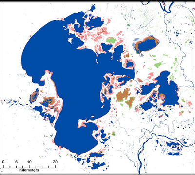
 as a difference map from 1991 to 2011. Water for 1991-2011 is shown in blue, green 2011, brown 2001, and red is water in 1991.")