
CMS: MODIS GPP, fPAR, and SST, and ENSO Index, Baja California, Mexico, 2000-2013
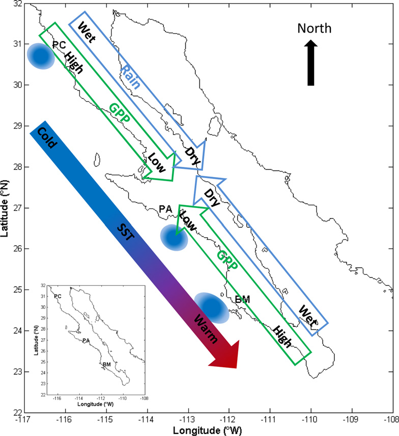
This data set provides data for MODIS-derived (1) gross primary productivity (GPP) for the years 2000-2010, (2) fraction of photosynthetically active radiation (fPAR) for the years 2003-2013, (3) sea surface temperature (SST) for the years 2003-2013, and (4) the NOAA-source Multivariate ENSO Index (MEI) data for the years 2003-2013 (as a measure of the El Nino/Southern Oscillation). The study areas were three transects on the Baja California Peninsula, Mexico, and the adjacent Pacific Ocean. The terrestrial transects, in order from North to South, West to East included Punta Colonet (three sites-PC1, PC2, PC3), Punta Abreojos (two sites-PA1, PA2), and Magdalena Bay (three sites-MB1, MB2, MB3).
Data Acknowledgements
Data authors: Reimer, J.J., R. Vargas, D. Rivas, G. Gaxiola-Castro, J.M. Hernandez-Ayon, and R. Lara-Lara.
Data Set DOI: http://dx.doi.org/10.3334/ORNLDAAC/1310
Data center: ORNL DAAC
Sponsor: NASA EOSDIS
, and ocean upwelling zones, Baja California, Mexico.")