
CARVE: CH4, CO2, and CO Atmospheric Concentrations, CARVE Tower, Alaska, 2012-2014
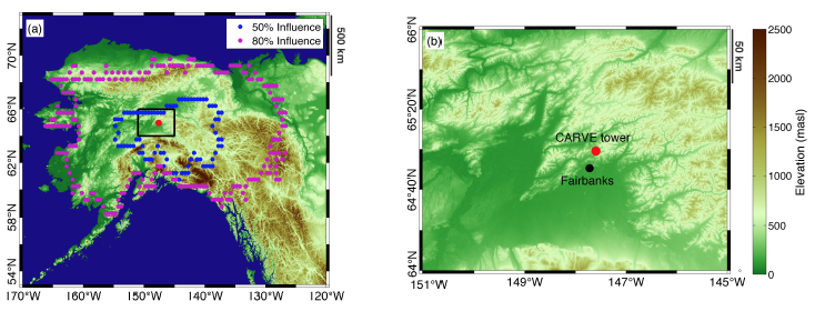
This data set provides hourly atmospheric concentrations of methane (CH4), carbon dioxide (CO2), and carbon monoxide (CO) as mole fractions, from January 2012 to December 2014 measured at the CARVE flux tower in Fox, Alaska (17 km north of Fairbanks) as part of NASA's Carbon in Arctic Reservoirs Vulnerability Experiment (CARVE). High-resolution meteorological fields from the Polar Weather Research and Forecasting (WRF) model coupled with the Stochastic Time-Inverted Lagrangian Transport model (WRF- STILT), along with the Polar Vegetation Photosynthesis and Respiration Model (PolarVPRM) were used to determine the influence region of the tower site and investigate the inter-annual and seasonal variability of regional fluxes of CO2 and CH4 in boreal Alaska using the tower observations. Modeled estimates of CH4, CO2, and CO background concentrations are provided. The WRF-STILT model "footprints" for the CARVE tower are provided with this data set.
Data Acknowledgements
Karion, A., C. Sweeney, J.B. Miller, A.E. Andrews, R. Commane, S.J. Dinardo, J. Henderson, J.O.W. Lindaas, J. Lin, K. Luus, T. Newberger, P. Tans, S.C. Wofsy, S. Wolter, and C.E. Miller.
Data Set DOI: http://dx.doi.org/10.3334/ORNLDAAC/1316
Data center: ORNL DAAC
Sponsor: NASA EOSDIS
 and 50% and 80% surface influence contours for the average WRF-STILT influence functions (from Karion et al 2016).")