DAAC Home > Resources > News

News

30-year record of forest phenology and wood production

Submitted by ORNL DAAC Staff on
Image Media
Location map of sites across the four study regions spanning the Appalachian Oak mesophytic forest of the eastern United States. The background maps for the park sites are the 30-year average phenology parameter, spring onset of greenness (spring_onset), as provided with this data set.
Image Media
Caption

Location map of sites across the four study regions spanning the Appalachian Oak mesophytic forest of the eastern United States. The background maps for the park sites are the 30-year average phenology parameter, spring onset of greenness (spring_onset), as provided with this data set.

Landsat-based Phenology and Tree Ring Characterization, Eastern US Forests, 1984-2013

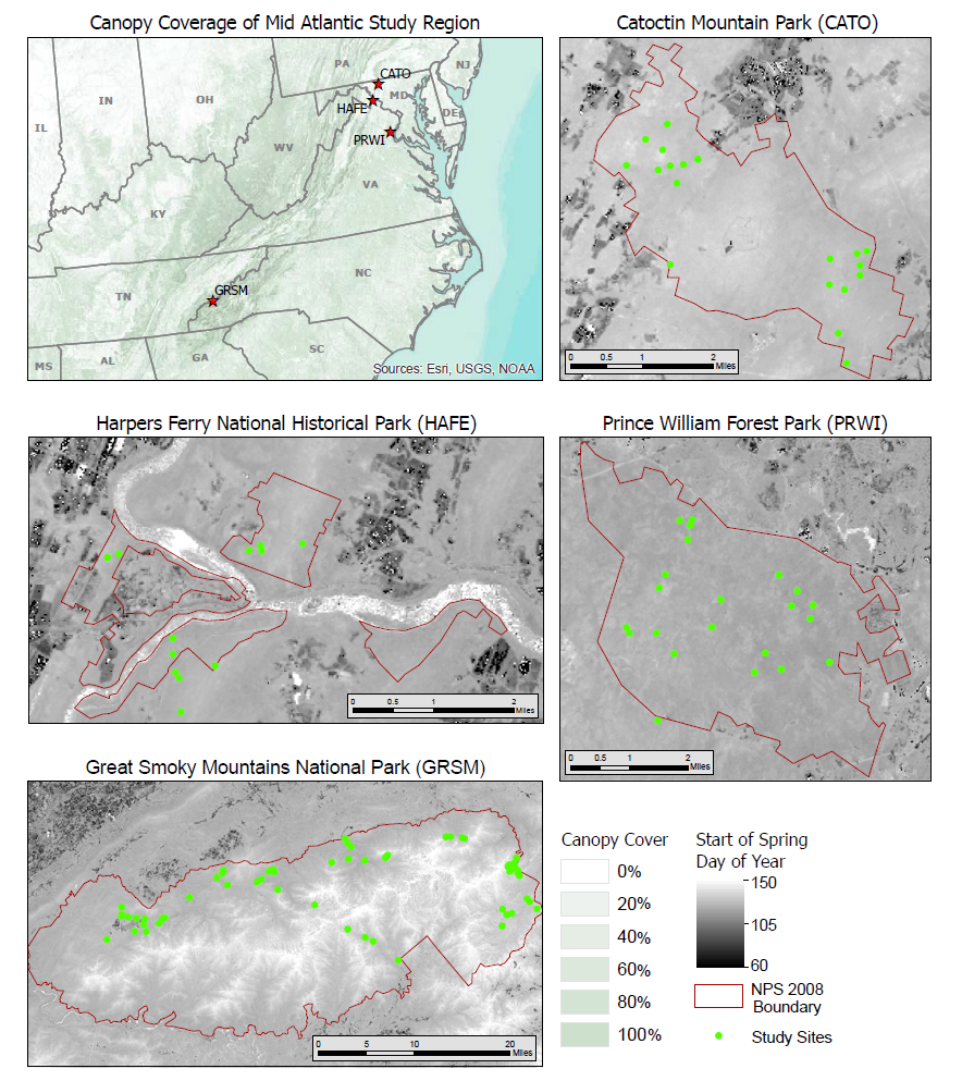
This data set provides a 30-year record of Landsat TM and ETM+ derived forest phenology and the results of tree ring analyses for annual wood production and nitrogen and carbon isotopic composition at 113 selected forested sites in the eastern United States. The sites are located in four national parks: Prince William Forest Park (PRWI), Harpers Ferry National Historical Park (HAFE), Catoctin Mountain Park (CATO), and Great Smoky Mountains National Park (GRSM). Phenology and tree ring data cover 1984-2013.

Data Acknowledgements
Data authors: Elmore, A.J., D. Nelson, S.M. Guinn, and R. Paulman.
Data Set DOI: http://dx.doi.org/10.3334/ORNLDAAC/1369
Data center: ORNL DAAC
Sponsor: NASA EOSDIS

Tags
Location map of sites across the four study regions spanning the Appalachian Oak mesophytic forest of the eastern United States. The background maps for the park sites are the 30-year average phenology parameter, spring onset of greenness (spring_onset), as provided with this data set.