
Climate change in the Arctic and Boreal region is unfolding faster than anywhere else on Earth. The Arctic-Boreal Vulnerability Experiment (ABoVE) is a NASA Terrestrial Ecology Field Campaign that seeks a better understanding of the vulnerability and resilience of ecosystems and society in this changing environment. ABoVE began in 2016 and is expected to continue through 2021. The program links field-based, process-level studies with geospatial data products derived from airborne and satellite sensors, providing a foundation for improving the analysis, along with modeling capabilities needed to understand and predict ecosystem responses and societal implications.
The ORNL DAAC has recently published 24 vegetation plot datasets In support of the ABoVE campaign. These data were curated with Pre-ABoVE support to the Alaska Arctic Geoecological Atlas (http://agc.portal.gina.alaska.edu), which provides access to existing Arctic vegetation plot and map data.
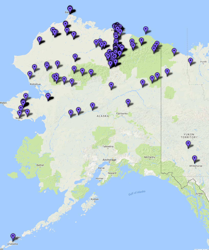
These datasets provide environmental, soil, and vegetation data collected from more than 3400 individual plots in Alaska, and the Yukon and the Northwest Territories of Canada. Collectively, the datasets provide data dating back to 1951, offering a useful historical baseline for comparison with more recent conditions.
The full list of ABoVE data at ORNL DAAC is available here: Dataset List
Related Publications:
Davidson, S.J., V. L. Sloan, G. K. Phoenix, R. Wagner, J. P. Fisher, W. Oechel and D. Zona. 2016. Vegetation type dominates the spatial variability in CH4 Emissions across multiple arctic tundra landscapes. Ecosystems 19:1116-1132. https://doi.org/10.1007/s10021-016-9991-0
Davidson, S. J., M. J. Santos, V. Sloan, J. D. Watts, W. C. Oechel, and D. Zona. 2016. Mapping Arctic Tundra Vegetation Communities Using Field Spectroscopy and Multispectral Satellite Data in North Alaska, U.S.A. Remote Sensing. 8(12):978. https://doi.org/10.3390/rs8120978

