
The ORNL DAAC recently released a new Arctic-Boreal Vulnerability Experiment (ABoVE) dataset by Macander, M.J., et al. (2021):
ABoVE: Tundra Plant Functional Type Continuous-Cover, North Slope, Alaska, 2010-2015
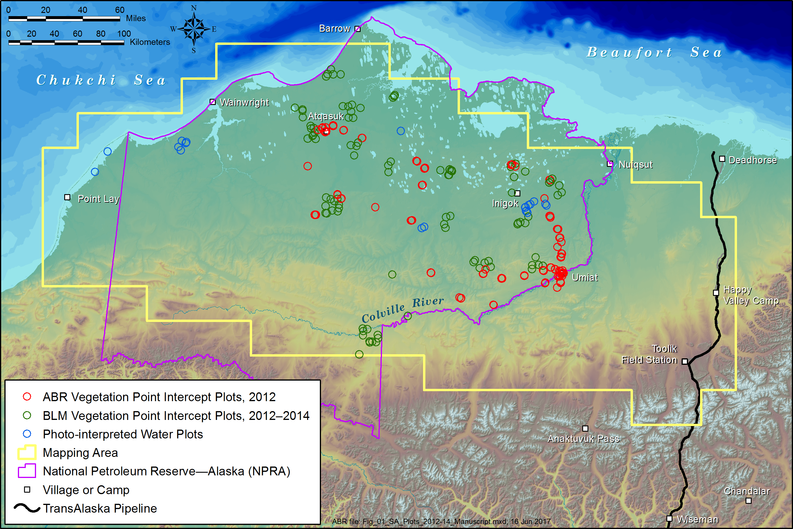
This dataset provides predicted continuous-field cover for tundra plant functional types (PFTs), across ~125,000 km2 of Alaska's North Slope at 30 m resolution. The data cover the period 2010-07-01 to 2015-08-31. The data were derived using a random forest data-mining algorithm, predictors derived from Landsat satellite observations (surface reflectance composites for ~15-day periods from May-August), and field vegetation cover and site characterization data spanning bioclimatic and geomorphic gradients. The field vegetation cover was stratified by nine PFTs, plus open water, bare ground, and litter, and using the cover metrics total cover (areal cover including the understory) and top cover (uppermost canopy or ground cover), resulting in a total of 19 field cover types. The field data and predictor values at the field sites are also included.
Citation: Macander, M.J., G.V. Frost, P.R. Nelson, and C.S. Swingley. 2020. ABoVE: Tundra Plant Functional Type Continuous-Cover, North Slope, Alaska, 2010-2015. ORNL DAAC, Oak Ridge, Tennessee, USA. https://doi.org/10.3334/ORNLDAAC/1830