
LiDAR-Derived Aboveground Biomass and Uncertainty for California Forests, 2005-2014
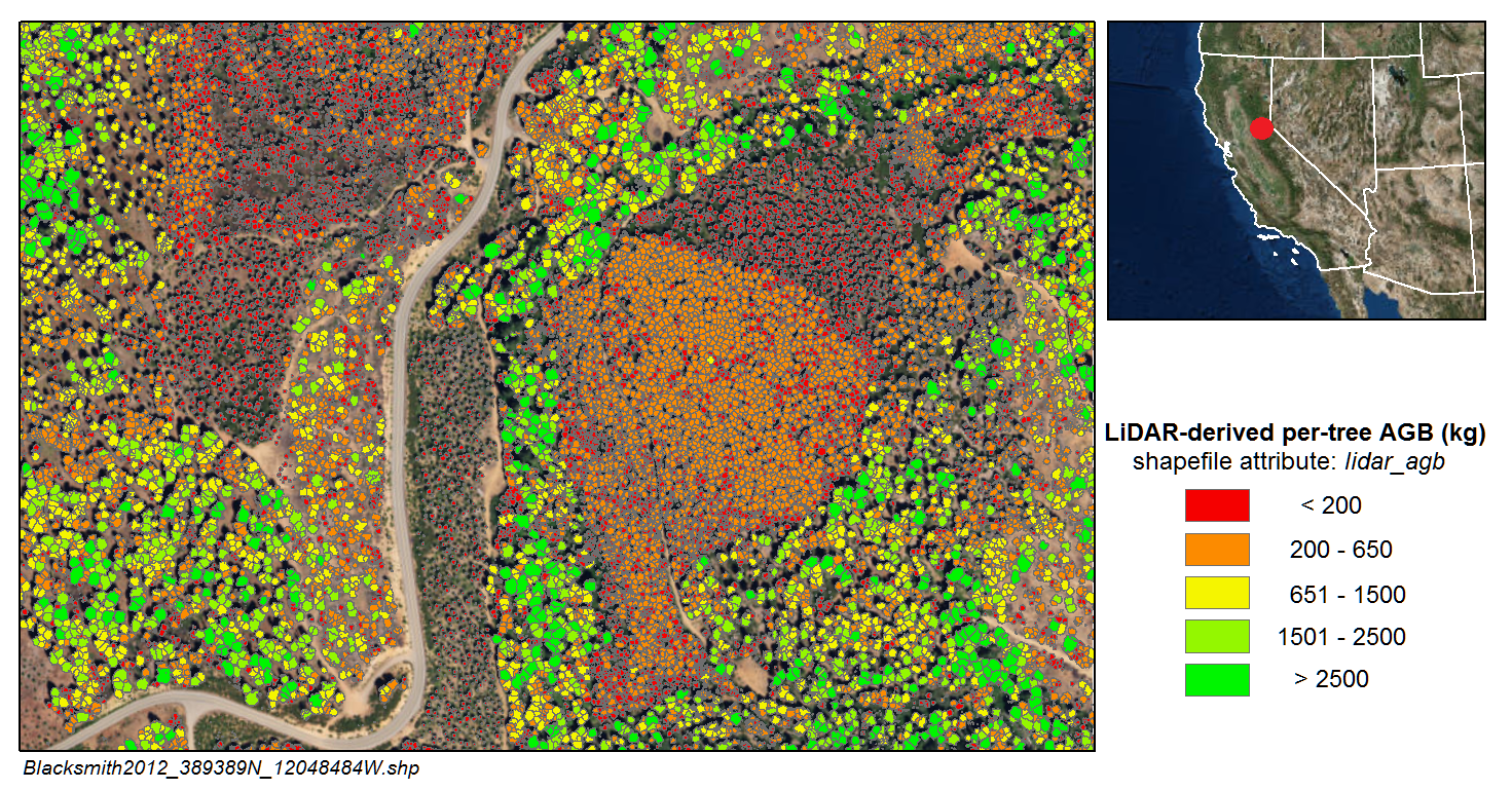
This dataset provides estimates of aboveground biomass and spatially explicit uncertainty from 53 airborne LiDAR surveys of locations throughout California between 2005 and 2014. Aboveground biomass was estimated by performing individual tree crown detection and applying a customized "remote sensing aware" allometric equation to these individual trees. Aboveground biomass estimates and their uncertainties for each study area are provided in per-tree and gridded format. The canopy height models used for the tree detection and biomass estimation are also provided.
Related Publication:
Xu, Q., Man, A., Fredrickson, M., Hou, Z., Pitkänen, J., Wing, B., Ramirez, C., Li, B. & Greenberg, A.J. Quantification of uncertainty in aboveground biomass estimates derived from small-footprint airborne LiDAR. Remote Sensing of Environment. 216: 514-528. https://doi.org/10.1016/j.rse.2018.07.022
Data Citation:
Xu, Q., and J. Greenberg. 2018. LiDAR-Derived Aboveground Biomass and Uncertainty for California Forests, 2005-2014. ORNL DAAC, Oak Ridge, Tennessee, USA https://doi.org/10.3334/ORNLDAAC/1537
Data center: ORNL DAAC
Sponsor: NASA EOSDIS
 per-tree derived from LiDAR at the Blacksmith site in 2012")