
CMS: LiDAR-derived Biomass, Canopy Height and Cover, Sonoma County, California, 2013
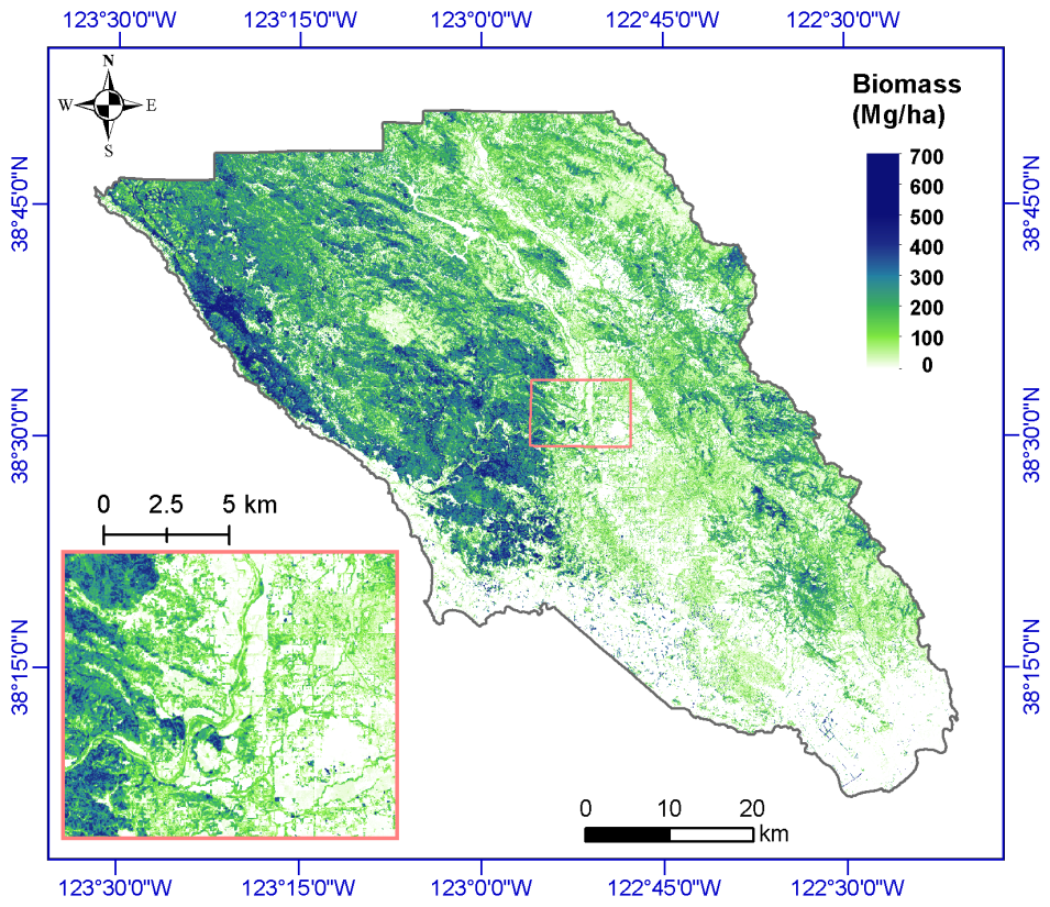
This data set provides estimates of above-ground biomass (AGB), canopy height, and percent tree cover at 30-m spatial resolution for Sonoma County, California, USA, for the nominal year 2013. Biomass estimates, megagrams of biomass per hectare (Mg/ha) were generated using a combination of LiDAR data, field plot measurements, and random forest modeling approaches. Estimates of AGB uncertainty are also provided. Maximum canopy height and tree cover were derived from LiDAR data and high-resolution National Agriculture Imagery Program (NAIP) images.
Data Citation
Dubayah, R.O., A. Swatantran, W. Huang, L. Duncanson, H. Tang, K. Johnson, J.O. Dunne, and G.C. Hurtt. 2017. CMS: LiDAR-derived Biomass, Canopy Height and Cover, Sonoma County, California, 2013. ORNL DAAC, Oak Ridge, Tennessee, USA. http://dx.doi.org/10.3334/ORNLDAAC/1523
Data center: ORNL DAAC
Sponsor: NASA EOSDIS
