
The ORNL DAAC recently released the following new AVIRIS dataset by Green, R.O., et al (2023):
AVIRIS Facility Instruments: Flight Line Geospatial and Contextual Data
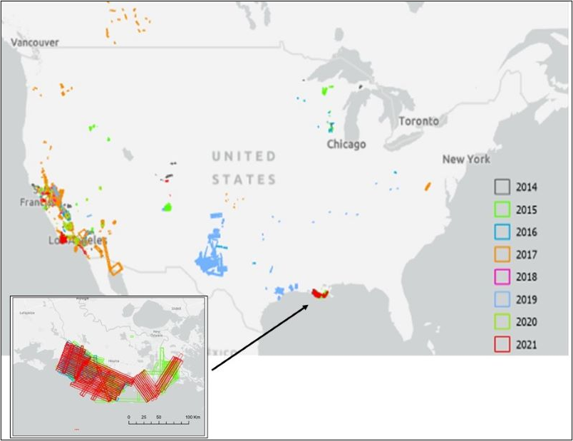
This dataset provides attributed geospatial and tabular information for identifying and querying flight lines of interest for the Airborne Visible InfraRed Imaging Spectrometer-Classic (AVIRIS-C) and Airborne Visible InfraRed Imaging Spectrometer-Next Generation (AVIRIS-NG) Facility Instrument collections. It includes an attributed shapefile containing polygon representation of individual flights lines for all years and separate KMZ files for each year which allows users to visualize and query flight line locations using Geographic Information System (GIS) software. Tables of AVIRIS-C and AVIRIS-NG flight lines with attributed information include dates, bounding coordinates, site names, investigators involved, flight attributes, associated campaigns, and corresponding file names for associated L1B (radiance) and L2 (reflectance) files in the AVIRIS-C and AVIRIS-NG Facility Instrument Collections
The Airborne Visible InfraRed Imaging Spectrometer - Classic (AVIRIS-C) and Next Generation (AVIRIS-NG) are two Facility Instruments (FIs) that are part of NASA’s Airborne Science Program (ASP) and the Jet Propulsion Laboratory’s (JPL) Earth Science Airborne Program. The AVIRIS-C is an imaging spectrometer that delivers calibrated images of the upwelling spectral radiance in 224 contiguous spectral channels with wavelengths from 400 to 2500 nanometers (nm). The AVIRIS-NG is the successor to AVIRIS-Classic and provides high signal-to-noise ratio imaging spectroscopy measurements in 425 contiguous spectral channels with wavelengths in the solar reflected spectral range (380-2510 nm). The AVIRIS-NG started operation in 2014 and is expected to replace the AVIRIS-C instrument. Data from AVIRIS-C and AVIRIS-NG have been applied to a wide range of studies in the fields of terrestrial and coastal aquatic plant physiology, atmospheric and aerosol studies, environmental science, snow hydrology, geology, volcanology, oceanography, soil and land management, agriculture, and limnology.
Additional data from AVIRIS-C and AVIRIS-NG and other relevant links can be found on the ORNL DAAC's AVIRIS project page.
Citation: Green, R.O., P.G. Brodrick, J.W. Chapman, M. Eastwood, S. Geier, M. Helmlinger, S.R. Lundeen, W. Olson-Duvall, R. Pavlick, L.M. Rios, D.R. Thompson, and A.K. Thorpe. 2023. AVIRIS Facility Instruments: Flight Line Geospatial and Contextual Data. ORNL DAAC, Oak Ridge, Tennessee, USA. https://doi.org/10.3334/ORNLDAAC/2140