CMS: Aboveground Biomass for Mangrove Forest, Zambezi River Delta, Mozambique
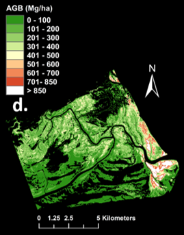
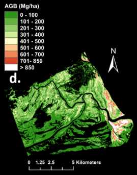
This dataset provides several estimates of aboveground biomass from various regressions and allometries for mangrove forest in the Zambezi River Delta, Mozambique. Plot level estimates of aboveground biomass are based on extensive tree biophysical measurements from field campaigns conducted in September and October of 2012 and 2013. Aboveground biomass estimates for the larger area of mangrove coverage within the delta are based on (1) the plot level data and (2) canopy structure data derived from airborne LiDAR surveys in 2014. The high-resolution canopy height model for the delta region derived from the airborne LiDAR data is also included.
A separate dataset provides high-resolution LiDAR point cloud data collected during surveys over mangrove forests in the Zambezi River Delta in Mozambique in May 2014. The LiDAR data are arranged into 1 km sq tiles.
Related Publication:
Fatoyinbo, T., E. Feliciano, D. Lagomasino, S. Lee, and C. Trettin. 2017. Estimating mangrove aboveground biomass from airborne LiDAR data: a case study from the Zambezi River delta. Environmental Research Letters. https://doi.org/10.1088/1748-9326/aa9f03
Data Citations:
Fatoyinbo, T., E. Feliciano, D. Lagomasino, S. Lee, and C. Trettin. 2017. CMS: Aboveground Biomass for Mangrove Forest, Zambezi River Delta, Mozambique. ORNL DAAC, Oak Ridge, Tennessee, USA. http://dx.doi.org/10.3334/ORNLDAAC/1522
Fatoyinbo, T., and C. Trettin. 2017. CMS: LiDAR Data for Mangrove Forests in the Zambezi River Delta, Mozambique, 2014. ORNL DAAC, Oak Ridge, Tennessee, USA.
http://dx.doi.org/10.3334/ORNLDAAC/1521
Data center: ORNL DAAC
Sponsor: NASA EOSDIS


