
CMS: CO2 Emissions from Fossil Fuels Combustion, ACES Inventory for Northeastern USA
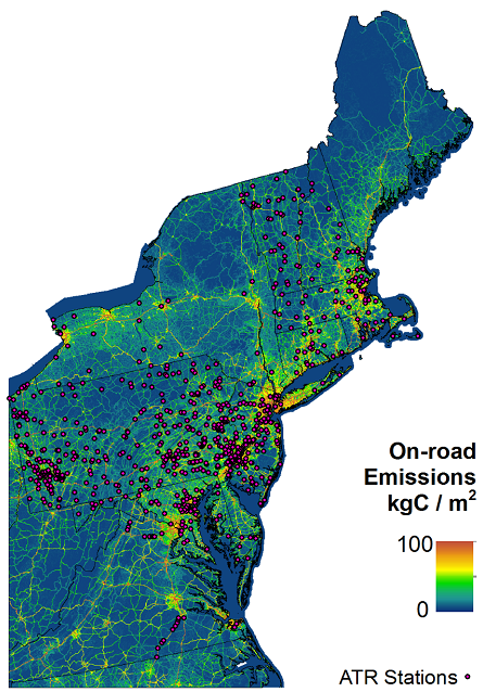
This dataset provides estimates of annual and hourly carbon dioxide (CO2) emissions from the combustion of fossil fuels (FF) for 13 states across the Northeastern United States. The Anthropogenic Carbon Emissions System (ACES) was used to estimate annual FFCO2 emissions for nine different emissions source sectors on a 1 x 1 km spatial grid, for the year 2011. Hourly estimates of FFCO2 for the years 2013 and 2014 were derived from the 2011 annual emissions by holding the total emissions constant, but accounting for seasonal and daily variations in meteorology, fuel consumption, and traffic patterns across these two years.
Related Paublication:
Gately, C. K., & Hutyra, L. R. 2017. Large uncertainties in urban-scale carbon emissions. Journal of Geophysical Research: Atmospheres, 122, 11,242–11,260. https://doi.org/10.1002/2017JD027359
Data Citation:
Gately, C., and L.R. Hutyra. 2017. CMS: CO2 Emissions from Fossil Fuels Combustion, ACES Inventory for Northeastern USA. ORNL DAAC, Oak Ridge, Tennessee, USA. http://dx.doi.org/10.3334/ORNLDAAC/1501
Data center: ORNL DAAC
Sponsor: NASA EOSDIS
