
The ORNL DAAC recently released a new version of the GEDI L3 dataset by Dubayah, R.O., et al., 2021:
GEDI L3 Gridded Land Surface Metrics, Version 2
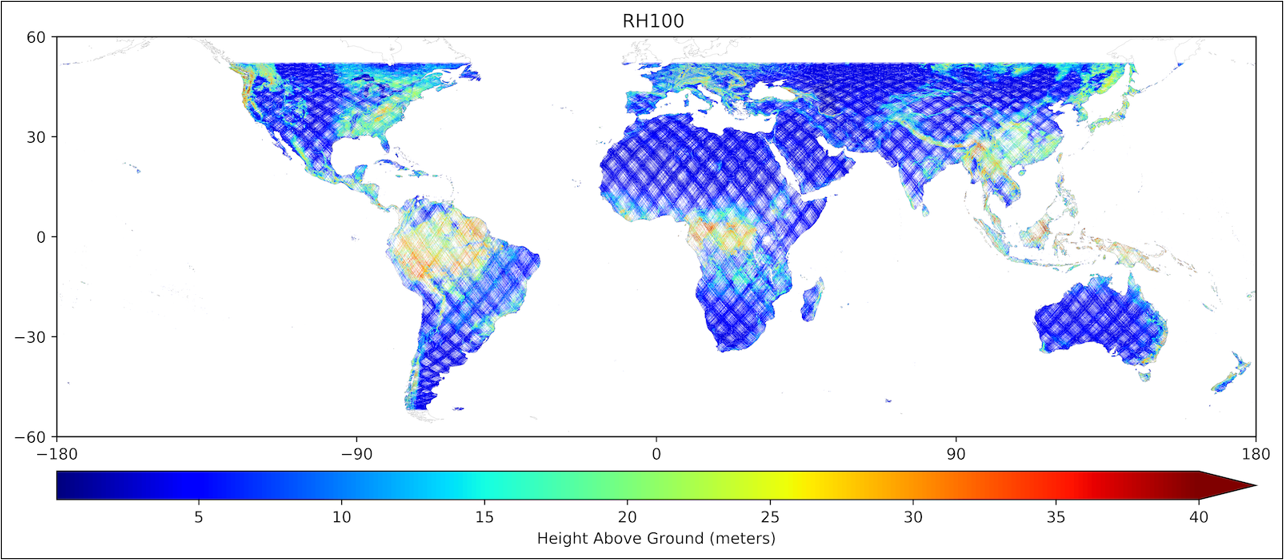
This dataset provides Global Ecosystem Dynamics Investigation (GEDI) Level 3 (L3) gridded mean canopy height, standard deviation of canopy height, mean ground elevation, standard deviation of ground elevation, and counts of laser footprints per 1 km x 1 km grid cells globally within -52 and 52 degrees latitude. These L3 gridded products were derived from Level 2 (L2) geolocated laser footprint return profile metrics from the GEDI instrument onboard the International Space Station (ISS). Canopy height is provided as the mean height (in meters) above the ground of the received waveform signal that was the first reflection off the top of the canopy (RH100). Ground elevation is provided as the mean elevation (in meters) of the center of the lowest waveform mode relative to the WGS84 reference ellipsoid. L3 gridded products can be used to characterize important carbon and water cycling processes, biodiversity, habitat and can also be of immense value for climate modeling, forest management, snow and glacier monitoring, and the generation of digital elevation models. This dataset version uses Version 2 of the input L2 data, which includes improved geolocation of the footprints as well as a modified method to predict an optimum algorithm setting group.
If you are ready to work with this data, check out the tutorials available from the ORNL DAAC or explore the data through our Global Subsets Tool.
The Global Ecosystem Dynamics Investigation (GEDI) produces high resolution laser ranging observations of the 3D structure of the Earth. GEDI’s precise measurements of forest canopy height, canopy vertical structure, and surface elevation greatly advance our ability to characterize important carbon and water cycling processes, biodiversity, and habitat. GEDI was funded as a NASA Earth Ventures Instrument (EVI) mission. It was launched to the International Space Station in December 2018 and completed initial orbit checkout in April 2019.
Additional data from the GEDI mission can be found on the GEDI Project Page.
Citation: Dubayah, R.O., S.B. Luthcke, T.J. Sabaka, J.B. Nicholas, S. Preaux, and M.A. Hofton. 2021. GEDI L3 Gridded Land Surface Metrics, Version 2. ORNL DAAC, Oak Ridge, Tennessee, USA. https://doi.org/10.3334/ORNLDAAC/1952