
The ORNL DAAC has released new GEDI Level 4A data available for 2022-12-22 through 2023-03-16 (GEDI mission weeks 211 through 223).
GEDI L4A Footprint Level Aboveground Biomass Density, Version 2.1
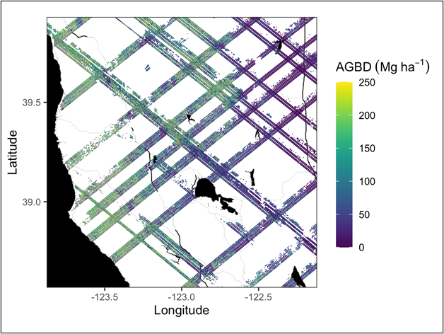
The GEDI L4A data provides predictions of the aboveground biomass density (AGBD; in Mg/ha) and estimates of the uncertainty within each sampled geolocated laser footprint. The data is available through various NASA Earthdata data tools and services, including Earthdata Cloud, OpeNDAP, and Harmony. The tutorials on accessing GEDI L4A are available at: https://github.com/ornldaac/gedi_tutorials
On March 17th, 2023, GEDI was temporarily moved to an [alternate location on ISS](https://www.earthdata.nasa.gov/news/nasa-announces-pause-gedi-mission), where it will remain offline for about 18 months. In 2024, GEDI will return to its original location and resume operations on the station.
The Global Ecosystems Dynamics Investigation produces high-resolution laser ranging observations of the 3D structure of the Earth. GEDI’s precise measurements of forest canopy height, canopy vertical structure, and surface elevation greatly advance our ability to characterize important carbon and water cycling processes, biodiversity, and habitat. GEDI was funded as a NASA Earth Ventures Instrument (EVI) mission. It was launched to the International Space Station in December 2018 and completed initial orbit checkout in April 2019.
Additional data from the GEDI mission can be found on the ORNL DAAC's GEDI Project Page (Levels 3 and 4) and through the Land Processes DAAC's GEDI Data Catalog (Levels 1 and 2).
Data Citation: Dubayah, R.O., J. Armston, J.R. Kellner, L. Duncanson, S.P. Healey, P.L. Patterson, S. Hancock, H. Tang, J. Bruening, M.A. Hofton, J.B. Blair, and S.B. Luthcke. 2022. GEDI L4A Footprint Level Aboveground Biomass Density, Version 2.1. ORNL DAAC, Oak Ridge, Tennessee, USA. https://doi.org/10.3334/ORNLDAAC/2056