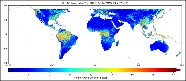
The ORNL DAAC has released new GEDI Level 3 granules covering April 2019 to March 2023 (GEDI mission weeks 19 through 223).
GEDI L3 Gridded Land Surface Metrics, Version 2
The GEDI L3 dataset provides gridded mean canopy height, standard deviation of canopy height, mean ground elevation, standard deviation of ground elevation, and counts of valid laser footprints per 1 km x 1 km grid cells.
On March 17th, 2023, GEDI was temporarily moved to an alternate location on ISS, where it will remain offline for about 18 months. In 2024, GEDI will return to its original location and resume operations on the station.
The Global Ecosystems Dynamics Investigation produces high-resolution laser ranging observations of the 3D structure of the Earth. GEDI’s precise measurements of forest canopy height, canopy vertical structure, and surface elevation greatly advance our ability to characterize important carbon and water cycling processes, biodiversity, and habitat. GEDI was funded as a NASA Earth Ventures Instrument (EVI) mission. It was launched to the International Space Station in December 2018 and completed initial orbit checkout in April 2019.
Additional data from the GEDI mission can be found on the ORNL DAAC's GEDI Project Page (Levels 3 and 4) and through the Land Processes DAAC's GEDI Data Catalog (Levels 1 and 2).
Citation: Dubayah, R.O., S.B. Luthcke, T.J. Sabaka, J.B. Nicholas, S. Preaux, and M.A. Hofton. 2021. GEDI L3 Gridded Land Surface Metrics, Version 2. ORNL DAAC, Oak Ridge, Tennessee, USA. https://doi.org/10.3334/ORNLDAAC/1952

