The MODerate-resolution Imaging Spectroradiometer (MODIS) was launched on board the Terra Satellite in 1999 and the Aqua (EOS PM) satellite in 2002. They are important and popular tools for tracking changes in large-scale global dynamics on land, the oceans, and the lower atmosphere. Recently, new MODIS Collection 6 products were released that offer calibration enhancements, refinements to the algorithms, and upstream product improvements.
The ORNL DAAC now offers MODIS Collection 6 Land Product subsets for any location, area, or time period globally. Collection 5 data are no longer available through these services.
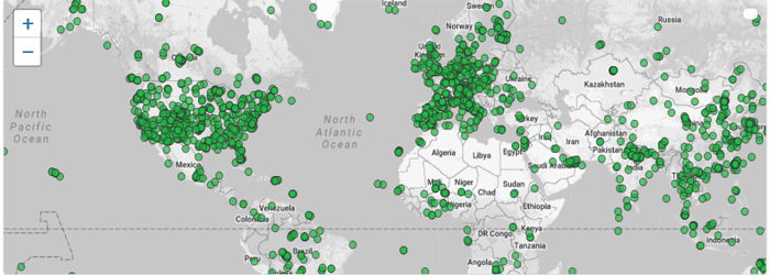
Pre-processed MODIS data at 2000+ locations: MODIS fixed sites
The MODIS fixed sites subsetting tool provides customized subsets and visualizations of MODIS Collection 6 land products for selected field and flux tower sites around the world. Spatial subsets of the products are available for predefined 8 X 8 km areas centered on the selected sites. The search tool enables users to select a site, a product, define the temporal range of interest, and either download the data or select from several data visualization options. The site-specific land product data can be downloaded in both comma separated value (*.csv) format via the MODIS fixed sites subsetting tool. The data are in sinusoidal projection.
Citation: ORNL DAAC. 2017. MODIS Collection 6 Fixed Sites Subsetting and Visualization Tool. ORNL DAAC, Oak Ridge, Tennessee, USA. https://doi.org/10.3334/ORNLDAAC/1567
The ORNL DAAC also offers a MODIS Global Subsets Tool where users can request a subset for any location on earth, and the data are also available through a web service.


