
ABoVE: Permafrost Measurements and Distribution Across the Y-K Delta, Alaska, 2016
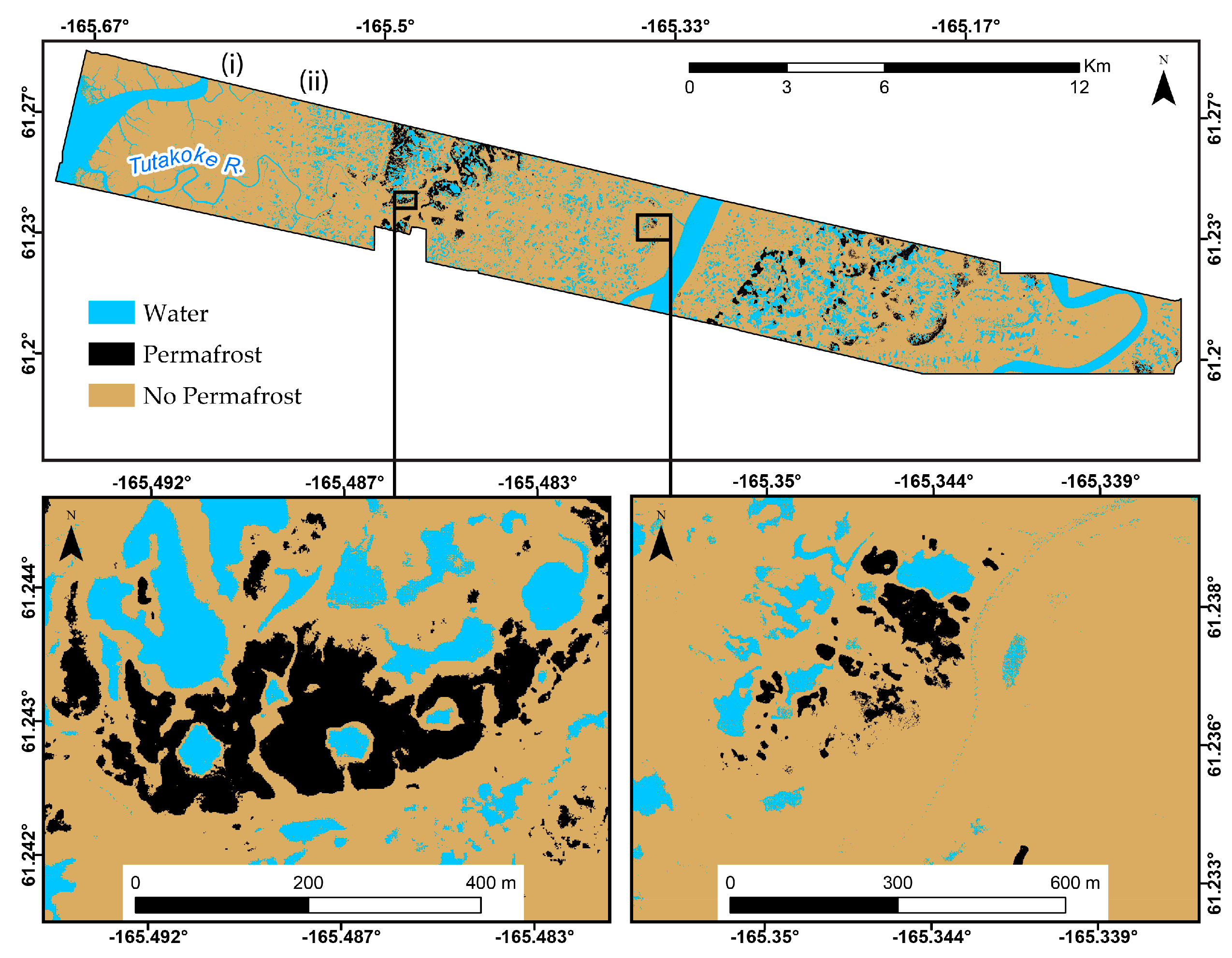
This dataset provides field observations of thaw depth and dominant vegetation types, a LiDAR-derived elevation map, and permafrost distribution and probability maps for an area on the coastal plain of the Yukon-Kuskokwim (Y-K) Delta, in western Alaska, USA. These high-resolution permafrost maps support landscape change analyses and assessments of the impacts of climate change on permafrost in this region of high biological productivity, critical wildlife habitats, and subsistence-based human economy.
The Arctic-Boreal Vulnerability Experiment (ABoVE) is a NASA Terrestrial Ecology Program field campaign based in Alaska and western Canada. Research for ABoVE will provide a foundation for improving the analysis and modeling capabilities needed to understand and predict ecosystem responses and societal implications.
See all data from ABoVE
Data Citation: Whitley, M., G. Frost, M.T. Jorgenson, M. Macander, C.V. Maio, and S.G. Winder. 2018. ABoVE: Permafrost Measurements and Distribution Across the Y-K Delta, Alaska, 2016. ORNL DAAC, Oak Ridge, Tennessee, USA. https://doi.org/10.3334/ORNLDAAC/1598
Data Center: ORNL DAAC
Sponsor: NASA EODIS
