
The ORNL DAAC offers a variety of data products related to terrestrial biogeochemistry and ecological dynamics. Below, summaries of three peer-reviewed research articles illustrate how researchers have used ORNL DAAC data products to inform a variety of applications.
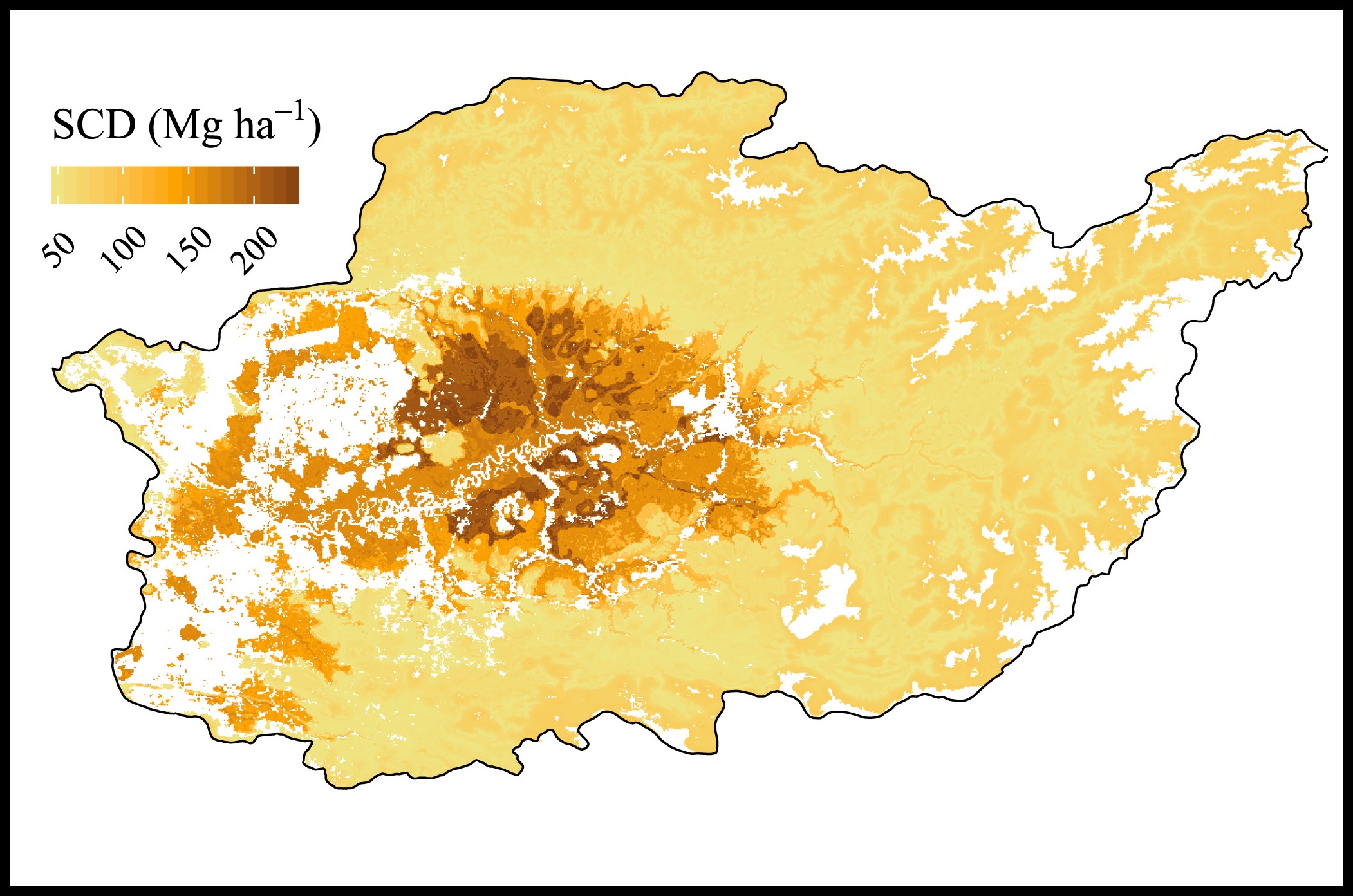
Harmonized World Soil Database used to examine spatial congruence of carbon and biodiversity hotspots
Soil carbon density (SCD) data from the Regridded Harmonized World Soil Database v1.2 were used to validate model predictions in a study of the spatial relationship between carbon storage and tree diversity in northern Borneo.
Weider et al. (2014) collected soil samples from select sites across northern Borneo, then developed models to predict carbon metrics over the entire study area. To determine if their models were robust, they compared predicted values with existing SCD data provided by the Regridded Harmonized World Soil Database. They found a significant positive relationship between their predictions of SCD and the top 30 cm soil carbon values in the Harmonized World Soil Database. There was also high congruence between the spatial distribution of SCD "hotspots" (i.e., areas of concentrated soil carbon).
SCD is a measure of carbon storage, which is important for ecosystem functioning and reducing atmospheric CO2. Northern Borneo faces deforestation with the development of oil palm plantations. The findings of Weider et al. (2014) inform conservation in Borneo because a high proportion of SCD hotspots were located in areas with high potential for human disturbance. According to the authors, "There is a need for more primary data from data-scarce regions to characterize the spatial distribution of, and spatial relationship between, carbon storage and biodiversity so as to guide decision making on land-use planning."
Data Product: Wieder, W.R., J. Boehnert, G.B. Bonan, and M. Langseth. 2014. Regridded Harmonized World Soil Database v1.2. ORNL DAAC, Oak Ridge, Tennessee, USA. https://doi.org/10.3334/ORNLDAAC/1247
Publication: Labrière, N., Locatelli, B., Vieilledent, G., Kharisma, S., Basuki, I., Gond, V. and Laumonier, Y., 2016. Spatial congruence between carbon and biodiversity across forest landscapes of northern Borneo. Global ecology and conservation, 6, pp.105-120.
Spatial Data Access Tool used to access land cover data for examining the impacts of urban growth on water availability in Baltimore
The Spatial Data Access Tool (SDAT) was used to retrieve data for models investigating long-term changes in land cover and water availability.
To understand the effect of the predicted pattern of urban growth on water availability in Baltimore, Bhaskar et al. (2016) developed a fully integrated, three-dimensional groundwater-surface water-land surface model (ParFlow.CLM) coupled with the urban growth model SLEUTH. Included in ParFlow.CLM, the MODIS Land Cover product MCD12Q1 provides a granule for the IGBP global vegetation classification scheme, which the authors accessed using SDAT.
Between 2007 and 2030, approximately 48.25 km2 (an increase of 7.8%) of the area outside the Baltimore urban core is expected to become urban land, and this urbanization will be coupled with generally modest decreases in subsurface water storage, but with high spatial heterogeneity . "While Maryland may seem to be an unlikely place for water shortages owing to its temperate climate, proximity to the Chesapeake Bay, and the dense network of streams covering the state," the authors write, "continued pressures from urban growth emanating from the Baltimore-Washington metropolitan area have resulted in warnings about potential future water shortages."
Data Access Tool: ORNL DAAC. 2017. Spatial Data Access Tool (SDAT). ORNL DAAC, Oak Ridge, Tennessee, USA. https://doi.org/10.3334/ORNLDAAC/1388
Publication: Bhaskar, A.S., Jantz, C., Welty, C., Drzyzga, S.A. and Miller, A.J., 2016. Coupling of the water cycle with patterns of urban growth in the Baltimore Metropolitan Region, United States. JAWRA Journal of the American Water Resources Association, 52(6), pp.1509-1523.
LEDAPS model aids research on the spatial–temporal changes of tropical forests in China
The LEDAPS Calibration, Reflectance, Atmospheric Correction Preprocessing Code, available through the Model Archive, was used to process images for the generation of forest cover maps for Hainan Island, China.
To understand tropical forest dynamics on Hainan Island, China, Chen et al. (2018) generated forest cover maps from a combination of optical images. In particular, the Landsat thematic mapper and enhanced thematic mapper plus surface reflectance images were processed using LEDAPS. LEDAPS, which stands for the Landsat ecosystem disturbance adaptive processing system, is a model that processes Landsat imagery to surface reflectance, using atmospheric correction routines developed for the Terra MODIS instrument.
The authors found that about 95% of forest gain and loss occurred where deciduous rubber, eucalyptus plantations, and urbanization expanded rapidly. "This study demonstrates the potential of … image fusion for monitoring annual forest dynamics in the tropical regions," contend the authors. LEDAPS and other imagery batch preprocessing tools are increasingly important to forest management because they allow for long-term time series change detection analyses.
Data Product: Masek, J.G., E.F. Vermote, N. Saleous, R. Wolfe, F.G. Hall, F. Huemmrich, F. Gao, J. Kutler, and T.K. Lim. 2013. LEDAPS Calibration, Reflectance, Atmospheric Correction Preprocessing Code, Version 2. Model product. ORNL DAAC, Oak Ridge, Tennessee, USA. https://doi.org/10.3334/ORNLDAAC/1146
Publication: Chen, B., Xiao, X., Ye, H., Ma, J., Doughty, R., Li, X., Zhao, B., Wu, Z., Sun, R., Dong, J. and Qin, Y., 2018. Mapping Forest and Their Spatial–Temporal Changes From 2007 to 2015 in Tropical Hainan Island by Integrating ALOS/ALOS-2 L-Band SAR and Landsat Optical Images. IEEE Journal of Selected Topics in Applied Earth Observations and Remote Sensing.

 for a region in northern Borneo")