
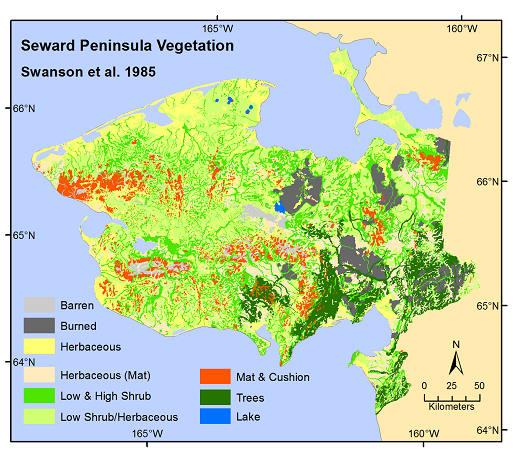
Pre-ABoVE: Land Cover and Vegetation Map Collection for Seward Peninsula, Alaska
This data set provides two landcover and vegetation maps for the Seward Peninsula, Alaska. These maps were produced from existing maps, Landsat imagery, and color infrared aerial photography covering the period 1976-06-01 to 1999-09-01.
Data Acknowledgements
Data authors: Raynolds, M.K., C. Thayer-Snyder, and J.D. Swanson
Data Set DOI: http://dx.doi.org/10.3334/ORNLDAAC/1363
Data center: ORNL DAAC
Sponsor: NASA EOSDIS
.")