
Pre-ABoVE: Land Cover and Vegetation Map, Arctic National Wildlife Refuge
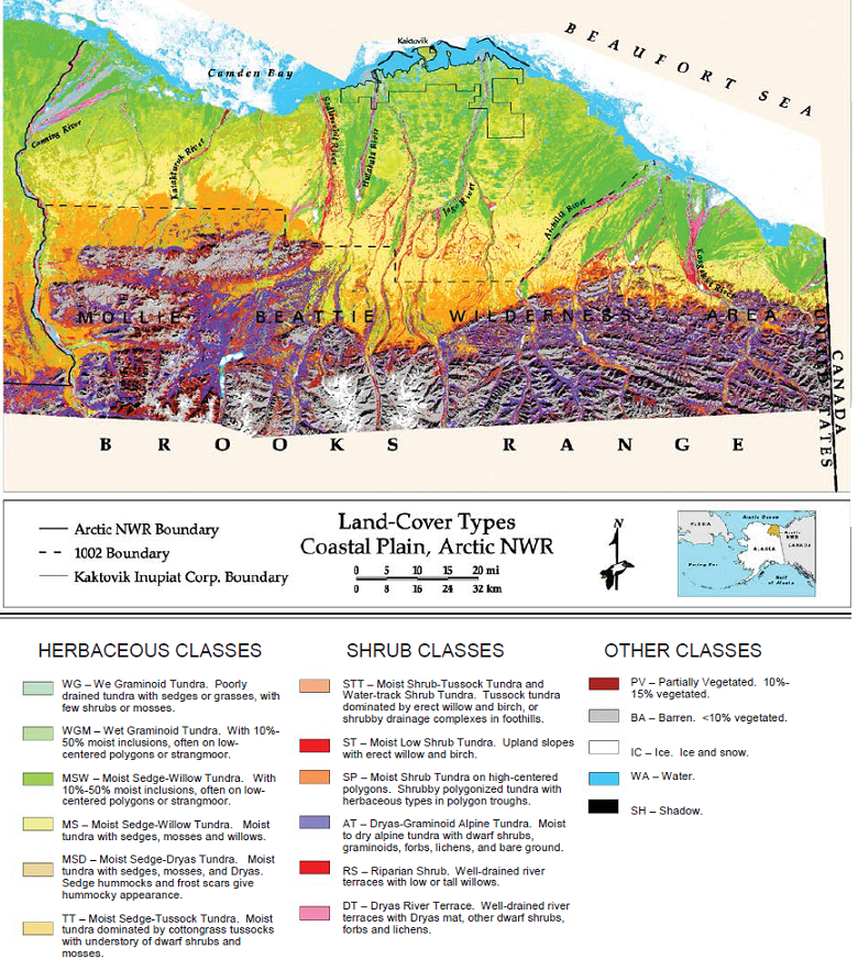
This data set provides a landcover map with 16 landcover classes for the northern coastal plain of the the Arctic National Wildlife Refuge (ANWR) on the North Slope of Alaska. The map covers a study area including 18,510 km2 of the coastal plains and adjacent mountains of the larger ANWR. The map was derived from Landsat Thematic Mapper (Landsat TM) data, Digital Elevation Models (DEMs), aerial photographs, existing maps, and extensive ground-truthing. The data used to derive the map cover the period 1982 to 1993.
Data Acknowledgements
Data authors: Jorgenson, J.C., P.E. Joria, T.R. Mccabe, B.R. Reitz, M.K. Raynolds, M. Emers, M.A. Willms, and D.A. Walker
Data Set DOI: http://dx.doi.org/10.3334/ORNLDAAC/1384
Data center: ORNL DAAC
Sponsor: NASA EOSDIS
.")