
CMS: LiDAR-derived Aboveground Biomass, Canopy Height and Cover for Maryland, 2011
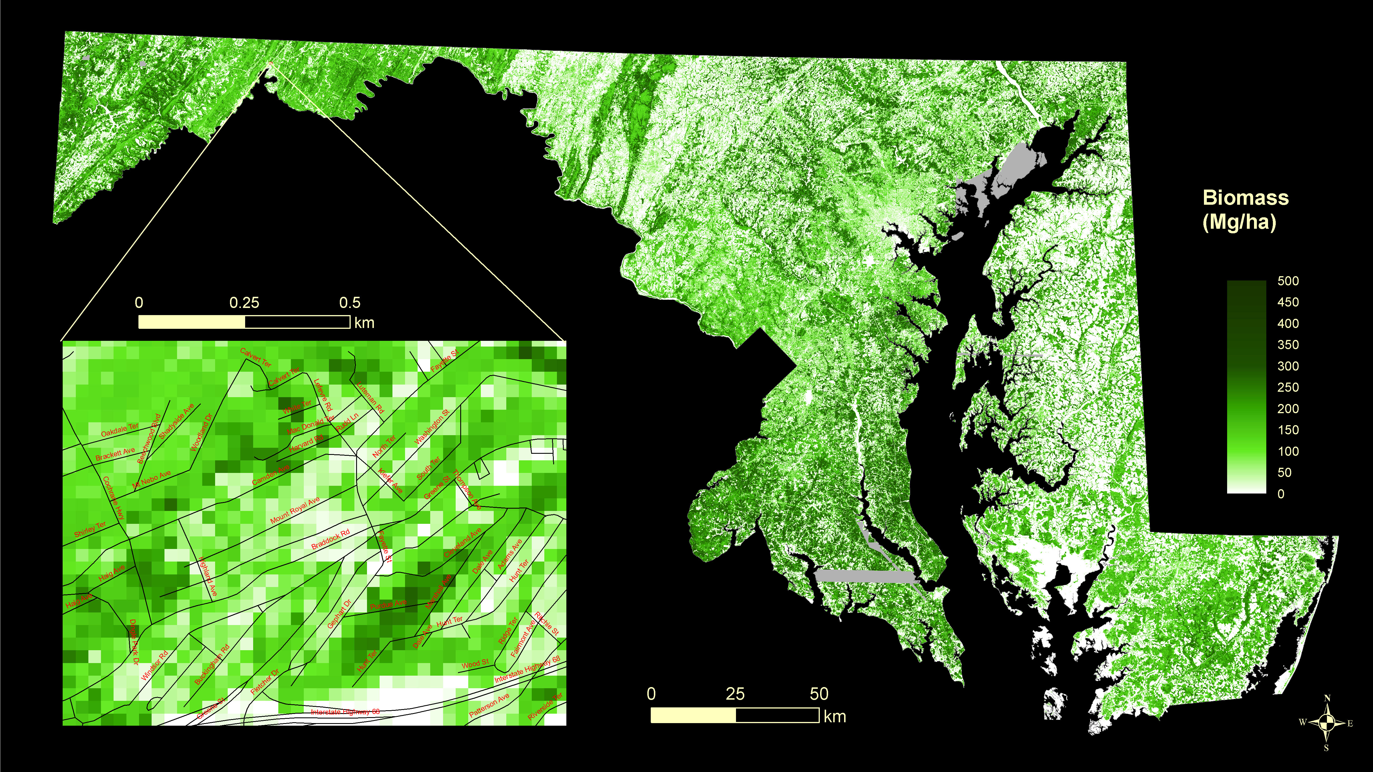
This data set provides 30-meter gridded estimates of aboveground biomass (AGB), canopy height, and canopy coverage for the state of Maryland in 2011. Leaf-off LiDAR data were combined with high-resolution leaf-on agricultural imagery to select 848 field sampling sites for biomass measurements. The field-based estimates were related to LiDAR height and volume metrics through random forests regression models across three physiographic regions of Maryland.
Data Acknowledgements
Data authors: Huang, W., A. Swatantran, K. Johnson, L. Duncanson, H. Tang, J.O. Dunne, G.C. Hurtt, and R.O. Dubayah.
Data Set DOI: http://dx.doi.org/10.3334/ORNLDAAC/1320
Data center: ORNL DAAC
Sponsor: NASA EOSDIS
 at 30-m resolution for the state of Maryland, 2011. Areas in grey (value = -1) indicate gaps in LiDAR coverage.")