
The ORNL DAAC recently released a new Carbon Monitoring System (CMS) dataset by Tang, H., et al. (2021):
LiDAR Derived Biomass, Canopy Height, and Cover for New England Region, USA, 2015
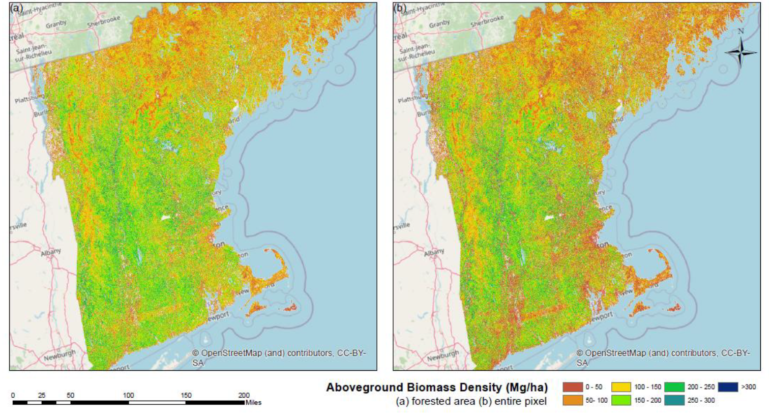
This dataset provides 30 m gridded estimates of aboveground biomass density (AGBD), forest canopy height, and tree canopy coverage for the New England Region of the U.S., including the states of Maine, Vermont, New Hampshire, Massachusetts, Connecticut, and Rhode Island, for the nominal year 2015. It is based on inputs from 1 m resolution Leaf-off LiDAR data collected from 2010 through 2015, high-resolution leaf-on agricultural imagery, and FIA plot-level measurements. Canopy height and tree cover were derived directly from LiDAR data while AGBD was estimated by statistical models that link remote sensing data and FIA plots at the pixel level. Error in AGBD was calculated at the 90% confidence interval. This approach can directly contribute to the formation of a cohesive forest carbon accounting system at national and even international levels, especially via future integrations with NASA's spaceborne LiDAR missions.
The NASA CMS program is designed to make significant contributions in characterizing, quantifying, understanding, and predicting the evolution of global carbon sources and sinks through improved monitoring of carbon stocks and fluxes. The System uses NASA satellite observations and modeling/analysis capabilities to establish the accuracy, quantitative uncertainties, and utility of products for supporting national and international policy, regulatory, and management activities. CMS data products are designed to inform near-term policy development and planning.
Additional data from CMS and other relevant links can be found on the ORNL DAAC's CMS Project Page.
Citation: Tang, H., L. Ma, A.J. Lister, J. O'Neil-Dunne, J. Lu, R. Lamb, R.O. Dubayah, and G.C. Hurtt. 2021. LiDAR Derived Biomass, Canopy Height, and Cover for New England Region, USA, 2015. ORNL DAAC, Oak Ridge, Tennessee, USA. https://doi.org/10.3334/ORNLDAAC/1854