
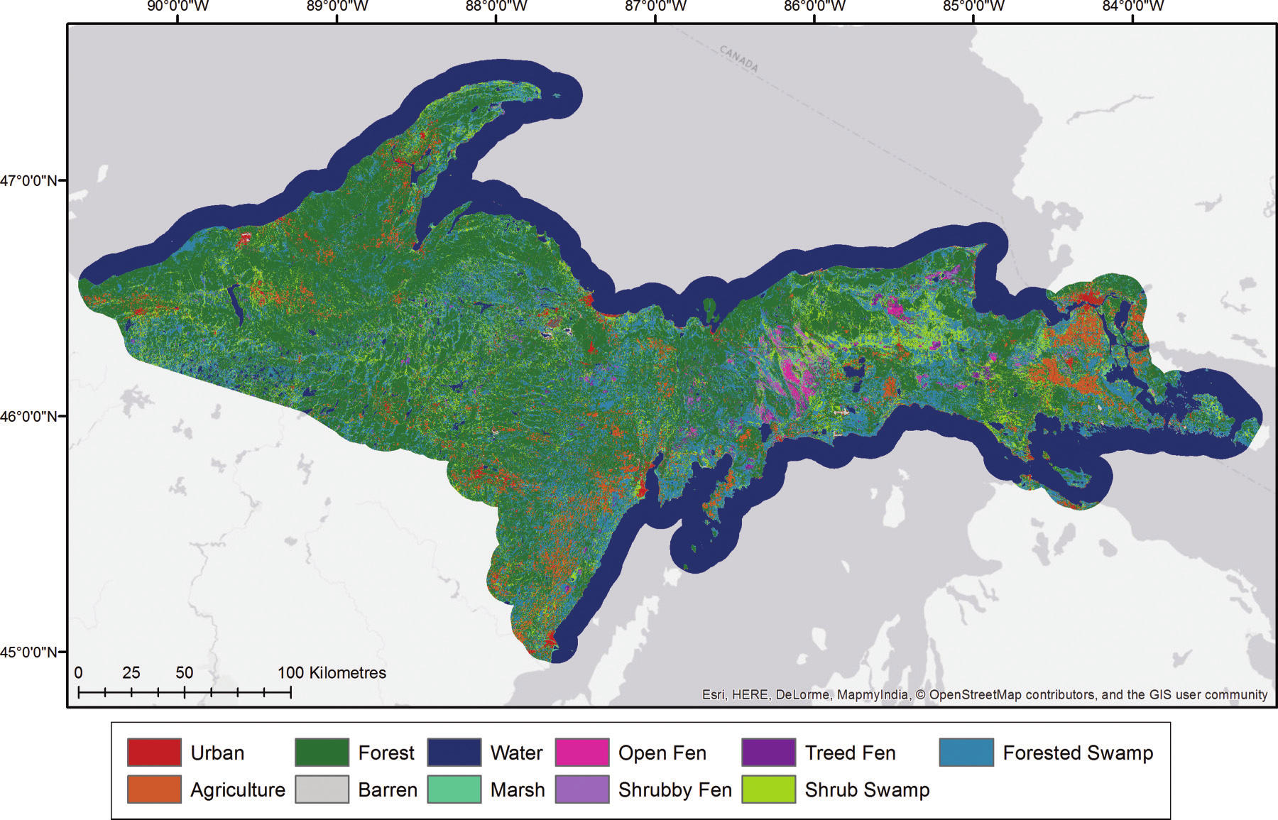
NACP Peatland Land Cover Map of Upper Peninsula, Michigan, 2007-2011
This dataset provides a land cover map focused on peatland ecosystems in the upper peninsula of Michigan. The map was produced at 12.5-m resolution using a multi-sensor fusion (optical and L-band SAR) approach with imagery from Landsat-5 TM and ALOS PALSAR collected between 2007 and 2011. A random forest classifier trained with polygons delineated from field data and aerial photography was used to determine pixel classes. Accuracy assessment based on field-sampled sites shows high overall map accuracy (92%).
Data Citation:
Bourgeau-Chavez, L.L., S. Endres, M. Battaglia, and E. Banda. 2017. NACP Peatland Land Cover Map of Upper Peninsula, Michigan, 2007-2011. ORNL DAAC, Oak Ridge, Tennessee, USA. http://dx.doi.org/10.3334/ORNLDAAC/1329
Data center: ORNL DAAC
Sponsor: NASA EOSDIS
