
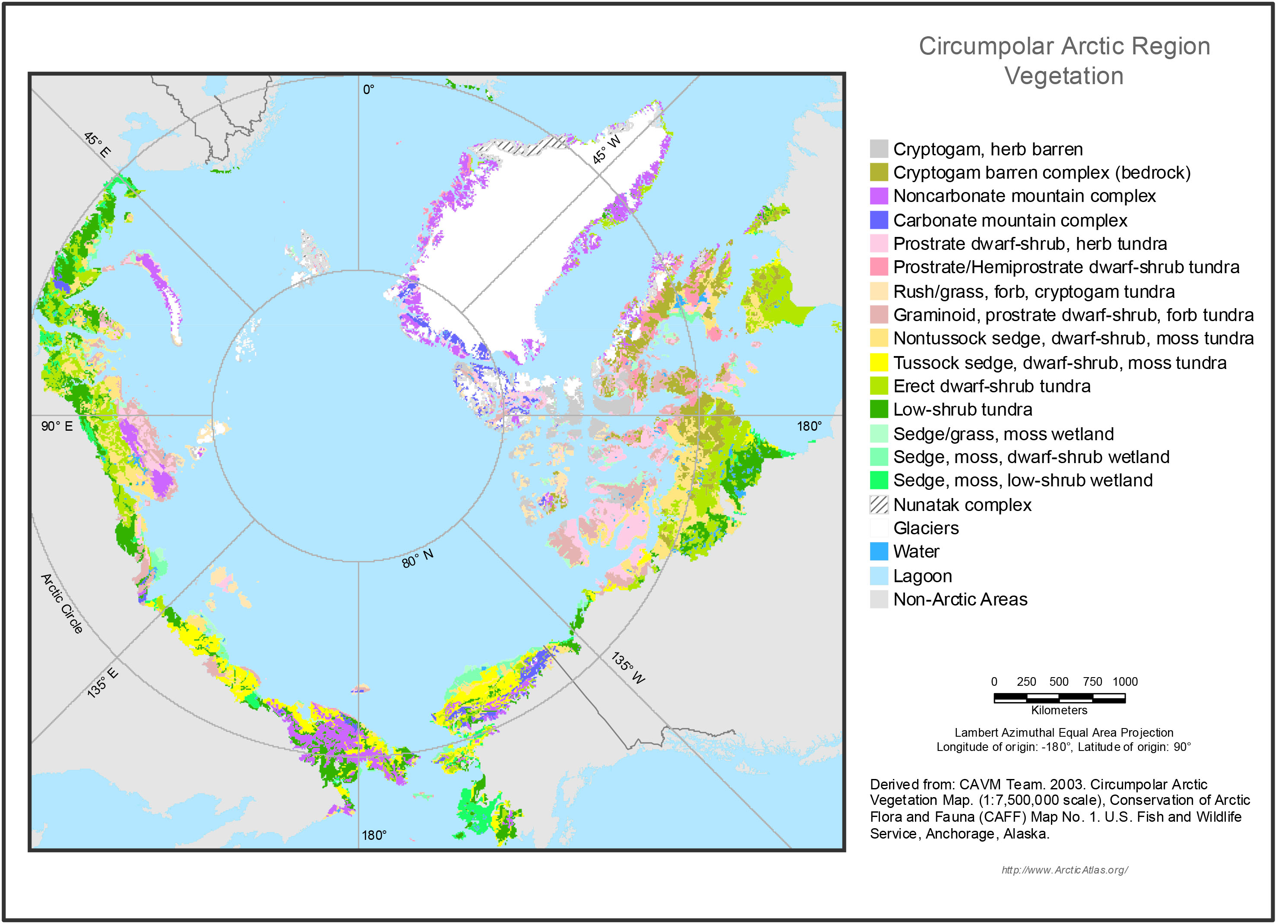
Pre-ABoVE: Circumpolar Arctic Vegetation, Geobotanical, Physiographic Data, 1982-2003
This data set provides the spatial distributions of vegetation types, geobotanical characteristics, and physiographic features for the circumpolar Arctic tundra biome for the period 1982-2003. Specific attributes include dominant vegetation, bioclimate subzones, floristic subprovinences, landscape types, lake coverage, Arctic treeline, elevation, and substrate chemistry data. Vegetation indices, trends, and biomass estimate products for the circumpolar Arctic through 2010 are also provided.
Data Acknowledgements
Data Authors: Walker, D.A., and M.K. Raynolds.
Data Set DOI: http://dx.doi.org/10.3334/ORNLDAAC/1323
Data center: ORNL DAAC
Sponsor: NASA EOSDIS
