
ABoVE: Wildfire Date of Burning within Fire Scars across Alaska and Canada, 2001-2015
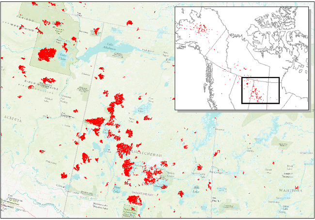
This dataset provides estimates of wildfire progression, as represented by date of burning (DoB), within fire scars across Alaska and Canada for the period 2001-2015. The estimated DoB was derived using an algorithm for identifying the first fire occurrence from the Moderate Resolution Imaging Spectroradiometer (MODIS) active fire detection product (MCD14ML, Collection 6) and to determine all dates of burning within fire scars. Burn scar locations were from the Alaskan Interagency Coordination Center (AICC) and the Natural Resources Canada (NRC) databases. All scars within these databases were used in this study and the MCD14ML product was filtered to the scar locations. The DoB data are provided as polygons to map the daily progression of a fire within each burn scar. That is, there is one polygon for each DoB detected within an identified burn scar boundary. Also provided are the MODIS active fire points associated with the burn scars.
Data Citation:
Loboda, T.V., and J.V. Hall. 2017. ABoVE: Wildfire Date of Burning within Fire Scars across Alaska and Canada, 2001-2015. ORNL DAAC, Oak Ridge, Tennessee, USA. https://doi.org/10.3334/ORNLDAAC/1559
Data center: ORNL DAAC
Sponsor: NASA EOSDIS
