
The NASA Carbon Monitoring System (CMS) is designed to make significant contributions in characterizing, quantifying, understanding, and predicting the evolution of global carbon sources and sinks through improved monitoring of carbon stocks and fluxes. The System will use the full range of NASA satellite observations and modeling/analysis capabilities to establish the accuracy, quantitative uncertainties, and utility of products for supporting national and international policy, regulatory, and management activities. CMS will maintain a global emphasis while providing finer scale regional information, utilizing space-based and surface-based data and will rapidly initiate generation and distribution of products both for user evaluation and to inform near-term policy development and planning.
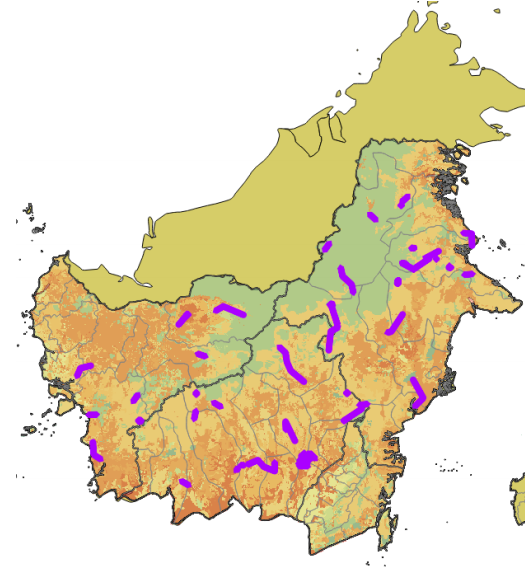
Two new CMS datasets provide LiDAR data collected from sites on the island of Borneo in Indonesia. The data were collected as part of an effort to establish a national forest monitoring system for Indonesia that uses a combination of remote sensing and ground-based forest carbon inventory approaches.
CMS: LiDAR Data for Forested Sites on Borneo Island, Kalimantan, Indonesia, 2014
This dataset provides airborne LiDAR point cloud data collected over 90 sites totaling approximately 100,000 hectares of forested land in Kalimantan, Indonesia on the island of Borneo in late 2014.
CMS: LiDAR-derived Canopy and Elevation for Sites in Kalimantan, Indonesia, 2014
This dataset provides canopy height and elevation data products derived from the LiDAR data above.
Data Citations
Melendy, L., S. Hagen, F.B. Sullivan, T. Pearson, S.M. Walker, P. Ellis, Kustiyo, K.A. Sambodo, O. Roswintiarti, M. Hanson, A.W. Klassen, M.W. Palace, B.H. Braswell, G.M. Delgado, S.S. Saatchi, and A. Ferraz. 2017. CMS: LiDAR Data for Forested Sites on Borneo Island, Kalimantan, Indonesia, 2014. ORNL DAAC, Oak Ridge, Tennessee, USA.http://dx.doi.org/10.3334/ORNLDAAC/1518
Melendy, L., S. Hagen, F.B. Sullivan, T. Pearson, S.M. Walker, P. Ellis, Kustiyo, K.A. Sambodo, O. Roswintiarti, M. Hanson, A.W. Klassen, M.W. Palace, B.H. Braswell, G.M. Delgado, S.S. Saatchi, and A. Ferraz. 2017. CMS: LiDAR-derived Canopy and Elevation for Sites in Kalimantan, Indonesia, 2014. ORNL DAAC, Oak Ridge, Tennessee, USA.http://dx.doi.org/10.3334/ORNLDAAC/1540
Data Center: ORNL DAAC
Sponsor: NASA EOSDIS
