
The ORNL DAAC now provides newly available Version 5 of the SMAP L4 Global Daily 9 km EASE-Grid Carbon Net Ecosystem Exchange (NEE) (SPL4CMDL) from its Fixed Sites Subsets Tool. The NSIDC DAAC, NASA’s archive of record for SMAP products, recently completed processing the latest version of the product, which includes several changes in the model inputs and model calibrations. The ORNL DAAC also distributes the SMAP soil moisture and NEE data products via its Soil Moisture Visualizer (SMV) which itself will be updated to Version 5 in the coming weeks.
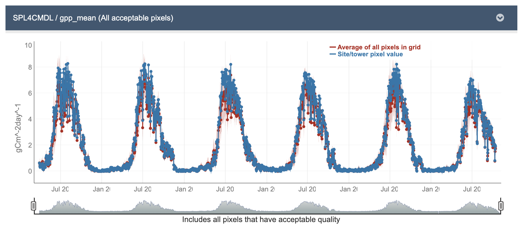
The SPL4CMDL product provides global gridded daily estimates of net ecosystem carbon (CO2) exchange derived using a satellite data based terrestrial carbon flux model informed by the following: Soil Moisture Active Passive (SMAP) L-band microwave observations, land cover and vegetation inputs from the Moderate Resolution Imaging Spectroradiometer (MODIS), Visible Infrared Imaging Radiometer Suite (VIIRS), and the Goddard Earth Observing System Model, Version 5 (GEOS-5) land model assimilation system. Parameters are computed using an Earth-fixed, global cylindrical 9 km Equal-Area Scalable Earth Grid, Version 2.0 (EASE-Grid 2.0) projection. SPL4CMDL has a spatial resolution of 9 km x 9 km, a temporal coverage from 31 March 2015 to present, and a daily temporal resolution.
The ORNL DAAC's Fixed Sites Subsets Tool provides customized subsets and visualizations of several MODIS/VIIRS land products and Daymet daily surface weather data for selected field and flux tower sites around the world. Spatial subsets of the land products are available for predefined areas of about 8 km x 8 km centered on the selected sites. The site-specific data can be downloaded in both comma separated value (*.csv) and JSON formats. The data are in the native projection system. Additional information and other relevant links can be found in the Fixed Sites Tool Documentation.
Data Citation: Kimball, J. S., L. A. Jones, A. Endsley, T. Kundig, and R. Reichle. 2020. SMAP L4 Global Daily 9 km EASE-Grid Carbon Net Ecosystem Exchange, Version 5. Boulder, Colorado USA. NASA National Snow and Ice Data Center Distributed Active Archive Center. https://doi.org/10.5067/9IKKQ4BL3PK8.
Tool Citation: ORNL DAAC. 2018. Fixed Sites Subsetting and Visualization Tool. ORNL DAAC, Oak Ridge, Tennessee, USA. https://doi.org/10.3334/ORNLDAAC/1567