
ABoVE: Peak Greenness for Canadian Boreal Forest from Landsat 5 TM Imagery, 1984-2011
The nature and magnitude of forest greening and browning are directly associated with climate change.
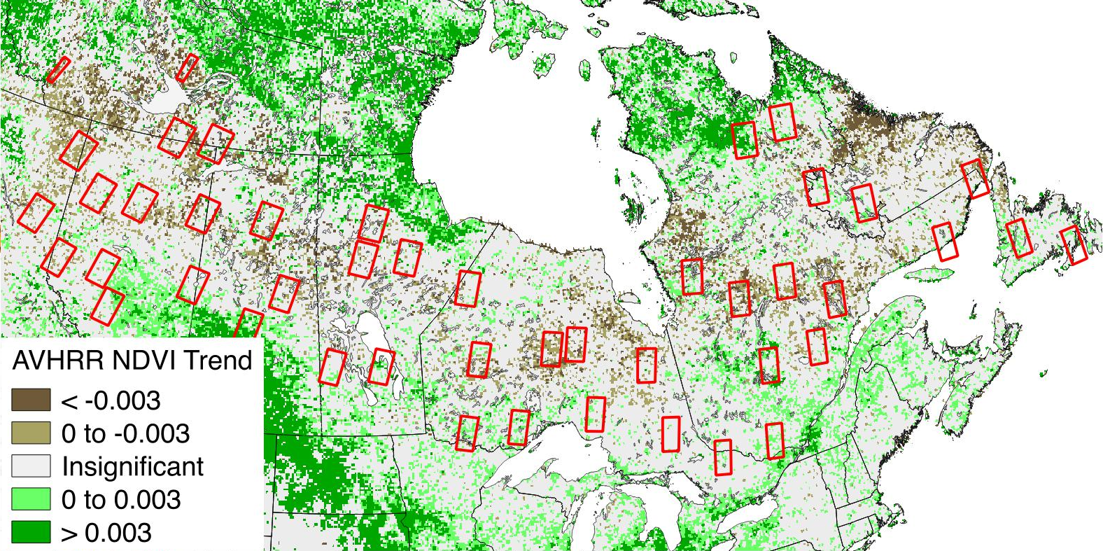
A new ABoVE dataset provides a 28-year time series of peak greenness (NDVI) data derived from Landsat 5 TM imagery over the boreal forest region of Canada. Landsat 5 TM scenes were collected for 46 selected sidelap sites along gradients in climate, tree cover, and disturbance history from 1984 to 2011. Peak-greenness reflectance was computed for 30-m Landsat pixels using the maximum normalized difference vegetation index (NDVI) along with the normalized burn ratio (NBR) during the period between days of the year (DOY) 180 and 204. To facilitate trend analysis at each site, the NDVI and NBR data of the 30-m Landsat pixels were regridded to the coarser MODIS 500-m (463.3-m) spatial scale to reduce the effects of missing data and to enhance the significance of the trend. The regridded NDVI and NBR 28-year time series data at 500-m resolution are provided for each of the 46 sites. Two trend analyses were run on the 500-m resolution data and are reported for each site. Supplemental site metadata are also provided, including the number of valid Landsat pixels, land cover composition, and fire disturbance history from 1970-2014, for each 500-m pixel.
Related Publication:
Sulla-Menashe, D, Woodcock. C. E., and Friedl, M. A. (2018). Canadian boreal forest greening and browning trends: an analysis of biogeographic patterns and the relative roles of disturbance versus climate drivers. Environmental Research Letters, 13(1): 1-8 https://dx.doi.org/10.1088/1748-9326/aa9b88.
Related Dataset:
Melaas, E.K., M.A. Friedl, and D. Sulla-Menashe. 2018. Landsat-derived Spring and Autumn Phenology, Eastern US - Canadian Forests, 1984-2013. ORNL DAAC, Oak Ridge, Tennessee, USA. https://doi.org/10.3334/ORNLDAAC/1570
Data Citation:
Sulla-Menashe, D., M.A. Friedl, C. Woodcock, and E.K. Melaas. 2018. ABoVE: Peak Greenness for Canadian Boreal Forest from Landsat 5 TM Imagery, 1984-2011. ORNL DAAC, Oak Ridge, Tennessee, USA. https://doi.org/10.3334/ORNLDAAC/1587
Data center: ORNL DAAC
Sponsor: NASA EOSDIS
