
Pre-ABoVE: Active Layer Thickness and Soil Water Content, Barrow, Alaska, 2013
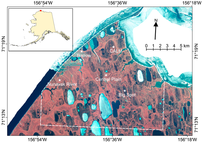
This data set provides estimates of Active Layer Thickness (ALT) determined with ground-based measurements, and calculated soil volumetric water content (VWC) at four selected sites around Barrow, Alaska in August 2013. ALT was determined using a ground-penetrating radar (GPR) system and traditional mechanical probing. Calculated uncertainties are also included. GPR measurements were taken along four transects of varying length (approx. 1 to 7 km). Mechanical probing included several high-density surveys (every 1 m within 100-m survey line) along each GPR transect. VWC of the active layer soil was calculated at 3-8 calibration points per site where the probe measurement was exactly co-located with a GPR trace.
Data Acknowledgements
Data Authors: Jafarov, E., A. Parsekian, K. Schaefer, L. Liu, A. Chen, S.K. Panda, and T. Zhang.
Data Set DOI: http://dx.doi.org/10.3334/ORNLDAAC/1355
Data center: ORNL DAAC
Sponsor: NASA EOSDIS
.")