The ORNL DAAC recently released a new Arctic-Boreal Vulnerability Experiment (ABoVE) dataset by Bourgeau-Chavez, L.L., et al. (2022):
ABoVE: Post-Fire and Unburned Vegetation Community and Field Data, NWT, Canada, 2017
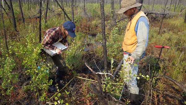
This dataset provides vegetation community characteristics, soil moisture, and biophysical data collected in 2017 from 11 study sites in the ABoVE Study area. The 11 study areas contained 28 sites that were burned by wildfires in 2014 and 2015, and 10 unburned sites in the Northwest Territories (NWT), Canada. Burned sites included peatland and upland. These field data include assessment of burn severity, vegetation inventories, ground cover, diameter and height for trees and shrubs, seedling and sprouting cover, soil moisture, and depth of unfrozen soil. Plot sizes were 10 m x 10 m with smaller subplots for selected measurements. Similar data were collected for these sites in the years 2015-2019 and are available in related separate datasets. Field data are provided in CSV format. The dataset includes digital photographs (in JPEG format) of vegetation conditions at sampling sites.
The ABoVE is a NASA Terrestrial Ecology Program field campaign being conducted in Alaska and western Canada, for 8 to 10 years, starting in 2015. Research for ABoVE links field-based, process-level studies with geospatial data products derived from airborne and satellite sensors, providing a foundation for improving the analysis, and modeling capabilities needed to understand and predict ecosystem responses to, and societal implications of, climate change in the Arctic and Boreal regions.
Additional data from ABoVE and other relevant links can be found on the ORNL DAAC's ABoVE Project Page.
Citation: Bourgeau-Chavez, L.L., S.E. Grelick, N.H.F. French, D. Tanzer, and E.S. Kane. 2022. ABoVE: Post-Fire and Unburned Vegetation Community and Field Data, NWT, Canada, 2017. ORNL DAAC, Oak Ridge, Tennessee, USA. https://doi.org/10.3334/ORNLDAAC/1771

