
Snowmelt Timing Maps Derived from MODIS for North America, 2001-2015
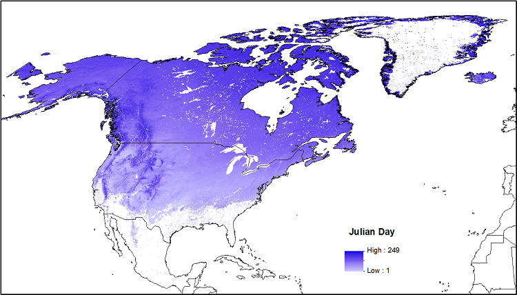
This data set provides snowmelt timing maps (STMs), cloud interference maps, and a map with the count of calculated snowmelt timing values for North America. The STMs are based on the Moderate Resolution Imaging Spectroradiometer (MODIS) standard 8-day composite snow-cover product MOD10A2 for the period 2001-01-01 to 2015-09-06. The STMs were created by conducting a time-series analysis of the MOD10A2 snow maps to identify the DOY of snowmelt on a per-pixel basis. Snowmelt timing (no-snow) was defined as a snow-free reading following two consecutive snow-present readings for a given 500-m pixel. The count of STM values is also reported, which represents the number of years on record in the STMs from 2001-2015.
Data Citation
O'Leary III, D., D.K. Hall, M. Medler, R. Matthews, and A. Flower. 2017. Snowmelt Timing Maps Derived from MODIS for North America, 2001-2015. ORNL DAAC, Oak Ridge, Tennessee, USA.
http://dx.doi.org/10.3334/ORNLDAAC/1504
Data center: ORNL DAAC
Sponsor: NASA EOSDIS
