
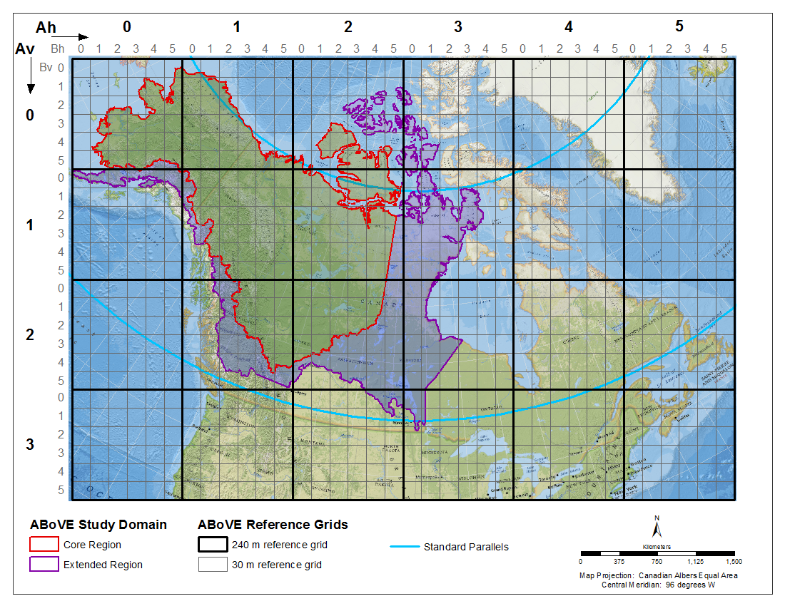
ABoVE: Study Domain and Standard Reference Grids
The Arctic - Boreal Vulnerability Experiment (ABoVE) has developed two standardized spatial data products to expedite coordination of research activities and to facilitate data interoperability. First, the ABoVE Study Domain encompasses the Arctic and boreal regions of Alaska, USA, and the western provinces of Canada, North America. Core and Extended study regions have been designated within this Domain and are provided in both a vector representation (Shapefile) and a raster representation (GeoTIFF at 1,000-meter pixel resolution). Second, a Standard Reference Grid System has been developed to cover the entire Study Domain and also extends to the eastern portion of North America. This Reference Grid is provided as a nested pair of polygon grids at scales of 240- and 30-meter spatial resolution. A shapefile is provided for each grid. Note that the designated standard projection for the all ABoVE products is the Canadian Albers Equal Area projection.
Data Acknowledgements
Data authors: Loboda, T.V., E.E. Hoy, and M.L. Carroll
Data Set DOI: http://dx.doi.org/10.3334/ORNLDAAC/1367
Data center: ORNL DAAC
Sponsor: NASA EOSDIS
