
The Atmospheric Carbon and Transport - America (ACT-America) project is a NASA Earth Venture Suborbital-2 mission that aims to study the transport and fluxes of atmospheric carbon dioxide and methane across the eastern United States. The project includes flight campaigns and ground-based measurements.
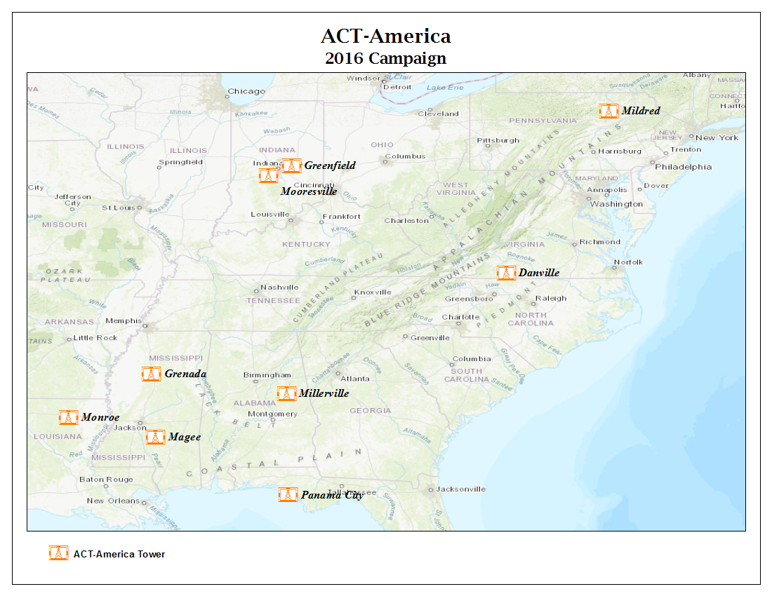
A new dataset provides atmospheric carbon dioxide (CO2), carbon monoxide (CO), and methane (CH4) concentrations as measured on a network of 9 instrumented communications towers operated by the ACT-America project.
ACT-America: L2 In Situ CO2, CO, and CH4 Concentrations from Towers, Eastern USA
These tower-based measurements began in early 2016 and are continuously collecting CO2, CO, and CH4 data to characterize ground-level carbon background conditions to support the periodic airborne measurement campaigns and transport modeling conducted by the project. The towers are instrumented with infrared cavity ring-down spectrometer systems (CRDS; Picarro Inc.). Data are reported for the highest sampling port on each tower, with heights ranging between 61 and 215 meters above ground level. The data averaging interval is 1 hour for 8 towers and 10 minutes for the Marcellus South - Mildred tower. The averaging interval standard deviation and uncertainty derived from periodic flask sample to in-situ measurement comparisons are provided. Complete tower location, elevation, instrument height, and date/time information are also provided.
Data from the year 2016 are now available.
Data Citation:
Miles, N.L., S.J. Richardson, D.K. Martins, K.J. Davis, T. Lauvaux, B.J. Haupt, and S.K. Miller. 2018. ACT-America: L2 In Situ CO2, CO, and CH4 Concentrations from Towers, Eastern USA. ORNL DAAC, Oak Ridge, Tennessee, USA. https://doi.org/10.3334/ORNLDAAC/1568
Data center: ORNL DAAC
Sponsor: NASA EOSDIS
