
ABoVE: Study Domain and Standard Reference Grids, Version 2
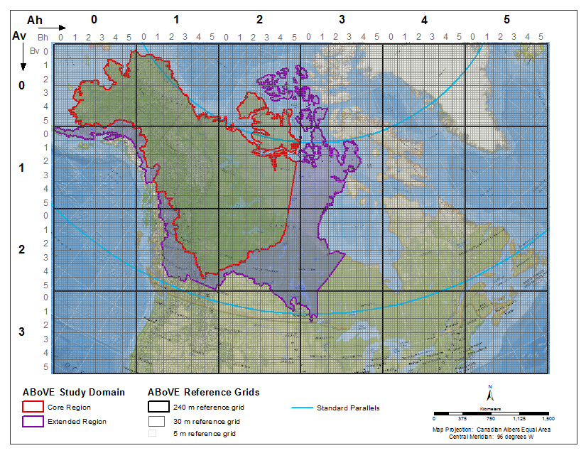
The Arctic - Boreal Vulnerability Experiment (ABoVE) has developed two standardized spatial data products to expedite coordination of research activities and to facilitate data interoperability. The ABoVE Study Domain encompasses the Arctic and boreal regions of Alaska, USA, and the western provinces of Canada, North America. Core and extended study regions have been designated within this Domain and are provided in both a vector representation (Shapefile) and a raster representation (GeoTIFF at 1,000-meter spatial resolution). A standard reference grid system has been developed to cover the entire study domain. This reference grid is provided as nested polygons at scales of 240, 30, and 5 meter spatial resolution. The 5 meter grid is new in Version 2. Note that the designated standard projection for the all ABoVE products is the Canadian Albers Equal Area projection.
Data Citation:
Loboda, T.V., E.E. Hoy, and M.L. Carroll. 2017. ABoVE: Study Domain and Standard Reference Grids, Version 2. ORNL DAAC, Oak Ridge, Tennessee, USA. https://doi.org/10.3334/ORNLDAAC/1527
Data center: ORNL DAAC
Sponsor: NASA EOSDIS
