
In 2014 and 2015, Canada's Northwest Territories saw extreme fire seasons not seen in at least three decades. With climate change predicting longer and drier summers, which result in longer fire seasons, the need to understand the impacts of these events is critical. The ORNL DAAC recently published two datasets produced by NASA's Arctic-Boreal Vulnerability Experiment (ABoVE) that examine these events. The investigation of wildfires included both ground-based observations and satellite monitoring.
Fieldwork in 2015 produced estimates of burn severity, woody seedlings, soil moisture, and tree diameter and height in areas burned in 2014. Fieldwork in 2016 focused on areas burned in 2014 and 2015. Detailed information on peatlands, peat depth, thaw depth, vegetation, and burn severity were collected in each burned area. Fire progression maps for the region in years 2014 and 2015 were produced from satellite data.
Data Citations
Bourgeau-Chavez, L.L., N.H.F. French, S. Endres, L. Jenkins, M. Battaglia, E. Serocki, and M. Billmire. 2016. ABoVE: Burn Severity, Fire Progression, Landcover and Field Data, NWT, Canada, 2014. ORNL DAAC, Oak Ridge, Tennessee, USA. http://dx.doi.org/10.3334/ORNLDAAC/1307
Bourgeau-Chavez, L.L., S. Endres, L. Jenkins, M. Battaglia, E. Serocki, and M. Billmire. 2017. ABoVE: Burn Severity, Fire Progression, and Field Data, NWT, Canada, 2015-2016. ORNL DAAC, Oak Ridge, Tennessee, USA. http://dx.doi.org/10.3334/ORNLDAAC/1548
For more data available from the ABoVE campaign, see ABoVE data
Data Center: ORNL DAAC
Sponsor: NASA EOSDIS
Image Media
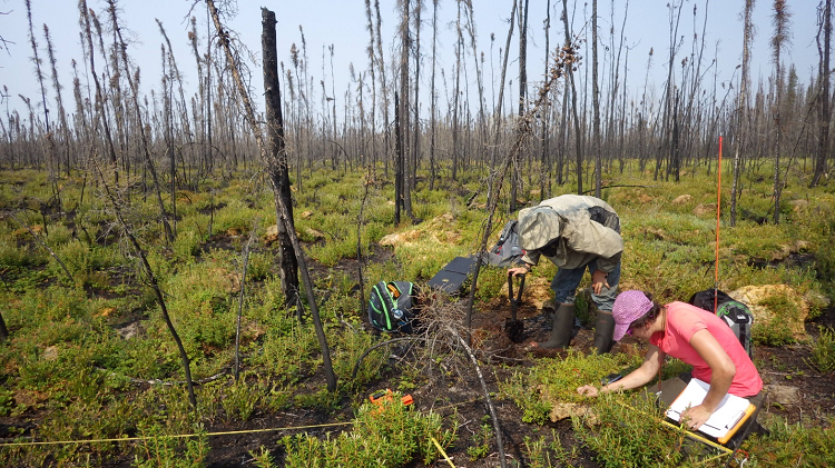
Image Media
Caption
Researchers examine a burned site near Kakisa in Canada's Northwest Territories as part of NASA's ABoVE field campaign.

Slider Image
