
The ORNL DAAC recently released two new Arctic-Boreal Vulnerability Experiment (ABoVE) datasets by Henderson, J., et al. (2021):
ABoVE: Level-4 WRF-STILT Footprint Files for Circumpolar Receptors, 2016-2019
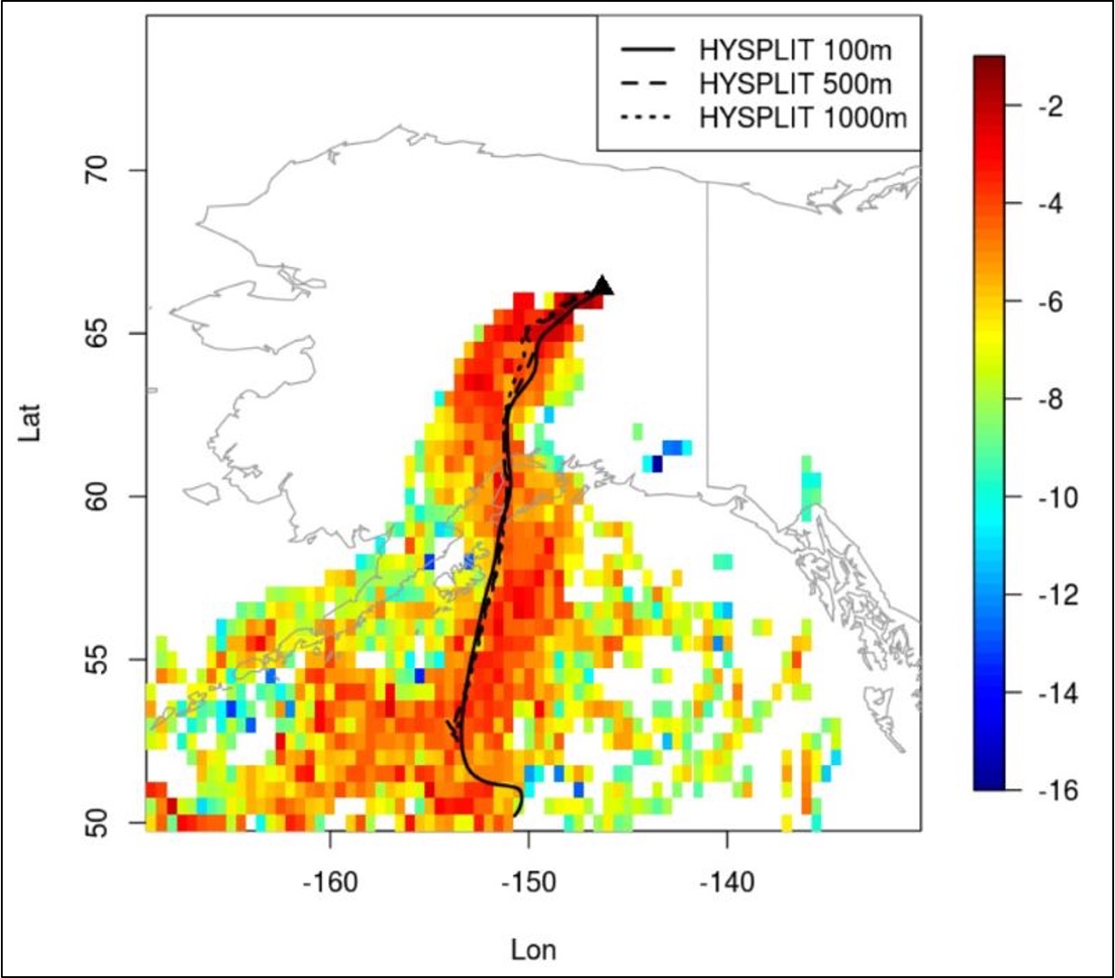
This dataset provides Weather Research and Forecasting (WRF) Stochastic Time-Inverted Lagrangian Transport (STILT) Footprint data products for receptors (observations) located at positions along flight paths and at various fixed observing sites at circumpolar locations at northern latitudes during 2016-2019. Each aircraft and station position is treated as an independent receptor in the WRF-STILT model in order to simulate the land surface influence on observed atmospheric constituents. The footprints are independent of chemical species and can be applied to different flux models and incorporated into formal inversion frameworks. The measurements included in this data set are crucial for understanding changes in Arctic carbon cycling and the potential threats posed by the thawing of Arctic permafrost.
ABoVE: Level-4 WRF-STILT Particle Trajectories for Circumpolar Receptors, 2016-2019
This dataset provides WRF-STILT particle trajectory files for receptors located at positions along flight paths and at various fixed observing sites at circumpolar locations above 45 degrees North during 2016-2019. The particle files describe the motion of particles released backward in time over a 10-day period. The particle files are available by platform type and characterized as either low resolution (0.5-degree) or high resolution (0.1-degree). The platforms include flux towers at fixed sites, laboratory measurements of whole air samples collected by Programmable Flask Packages (PFP) onboard aircraft, and observations by NASA's Orbiting Carbon Observatory-2 satellite. Companion footprint files are provided on a regular latitude-longitude grid. This dataset extends previous research on the atmospheric transport of land-surface emissions of greenhouse gases by the Carbon in Arctic Reservoirs Vulnerability Experiment (CARVE) project. In particular, the content of the low-resolution particle files is similar to those for the CARVE dataset.
The ABoVE is a NASA Terrestrial Ecology Program field campaign being conducted in Alaska and western Canada, for 8 to 10 years, starting in 2015. Research for ABoVE links field-based, process-level studies with geospatial data products derived from airborne and satellite sensors, providing a foundation for improving the analysis, and modeling capabilities needed to understand and predict ecosystem responses to, and societal implications of, climate change in the Arctic and Boreal regions.
Additional data from ABoVE and other relevant links can be found on the ORNL DAAC's ABoVE Project Page.
Citations:
Henderson, J., M. Mountain, A. Dayalu, K. McKain, L. Hu, and T. Nehrkorn. 2021. ABoVE: Level-4 WRF-STILT Footprint Files for Circumpolar Receptors, 2016-2019. ORNL DAAC, Oak Ridge, Tennessee, USA. https://doi.org/10.3334/ORNLDAAC/1896
Henderson, J., M. Mountain, A. Dayalu, K. McKain, L. Hu, and T. Nehrkorn. 2021. ABoVE: Level-4 WRF-STILT Particle Trajectories for Circumpolar Receptors, 2016-2019. ORNL DAAC, Oak Ridge, Tennessee, USA. https://doi.org/10.3334/ORNLDAAC/1895