ACT-America: L1 Meteorological and Aircraft Navigational Data
A new version of Level 1 meteorological and aircraft navigational data from the Atmospheric Carbon and Transport-America (ACT-America) project is available. This version includes updated Summer 2016 and Winter 2017 data, and additional data from Fall 2017, Spring 2018, and Summer 2019 campaigns. Measurements include, but are not limited to, latitude, longitude, altitude, ground speed, air temperature, and wind speed and direction.
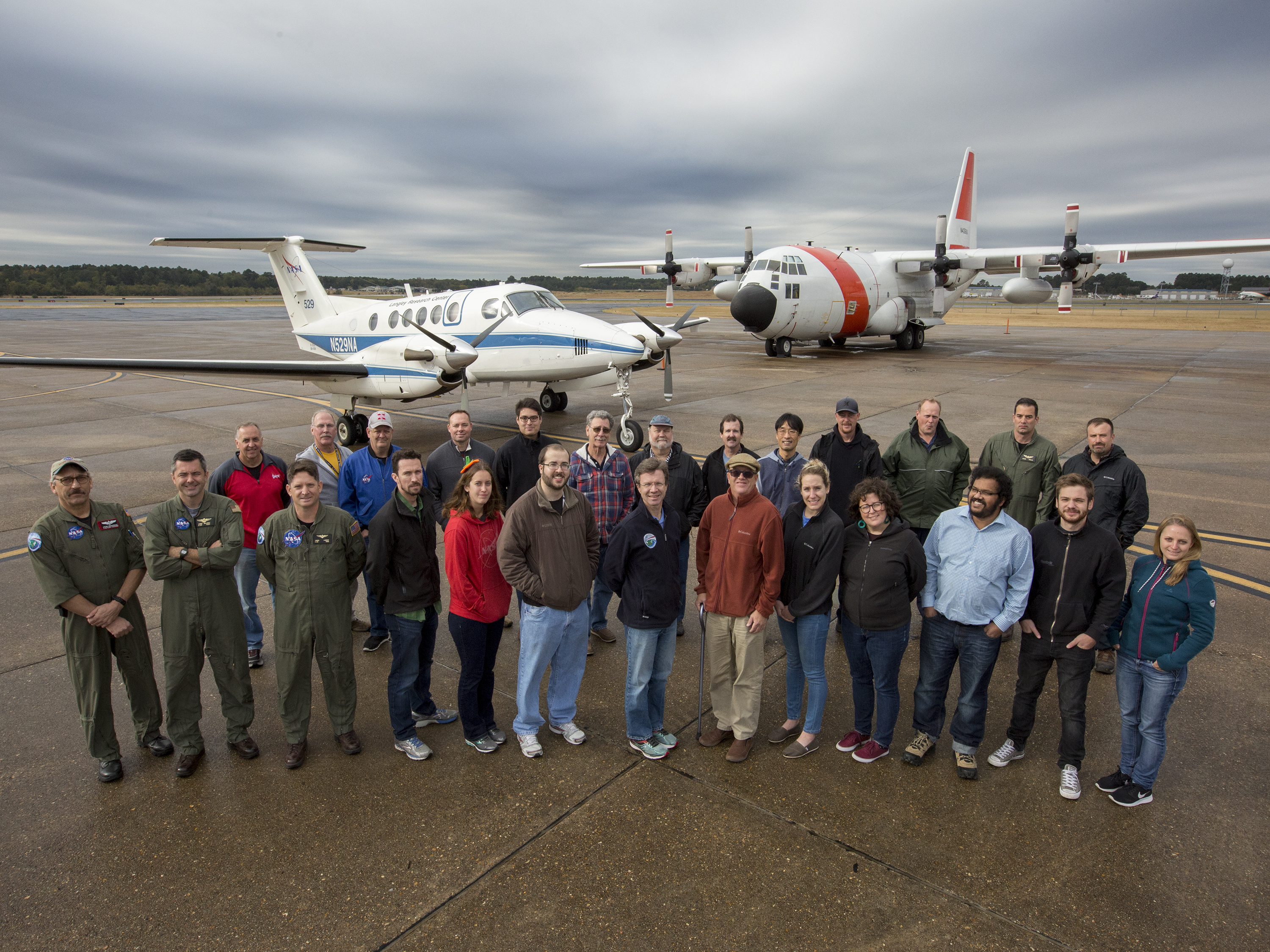
For this dataset, two instrumented aircraft platforms, the NASA Langley Beechcraft B200 King Air and the NASA Goddard Space Flight Center's C-130H Hercules, were used to collect high-quality in situ measurements across a variety of continental surfaces and atmospheric conditions. During the flights, aircraft positional, meteorological, and environmental data are recorded by a variety of instruments. These data (often referred to as "housekeeping" data) are used in related ACT-America flight-instrumented datasets to provide geotrajectory file information for position, attitude, and altitude awareness of instrumented sampling.
ACT-America is a NASA Earth Venture Suborbital-2 mission to study the transport and fluxes of atmospheric carbon dioxide and methane across three regions in the eastern United States. Flight campaigns measured transport of greenhouse gases by continental-scale weather systems. Ground-based measurements of greenhouse gases were also collected. Project goals include better estimates of greenhouse gas sources and sinks which are required for climate management and for prediction of future climate. See all ORNL DAAC data from ACT-America.
Data Citation: Yang, M.M., J.D. Barrick, C. Sweeney, J.P. DiGangi, and J.R. Bennett. 2018. ACT-America: L1 Meteorological and Aircraft Navigational Data. ORNL DAAC, Oak Ridge, Tennessee, USA. https://doi.org/10.3334/ORNLDAAC/1574

