
ABoVE: Active Layer Thickness Derived from Airborne L- and P-band SAR, Alaska, 2017
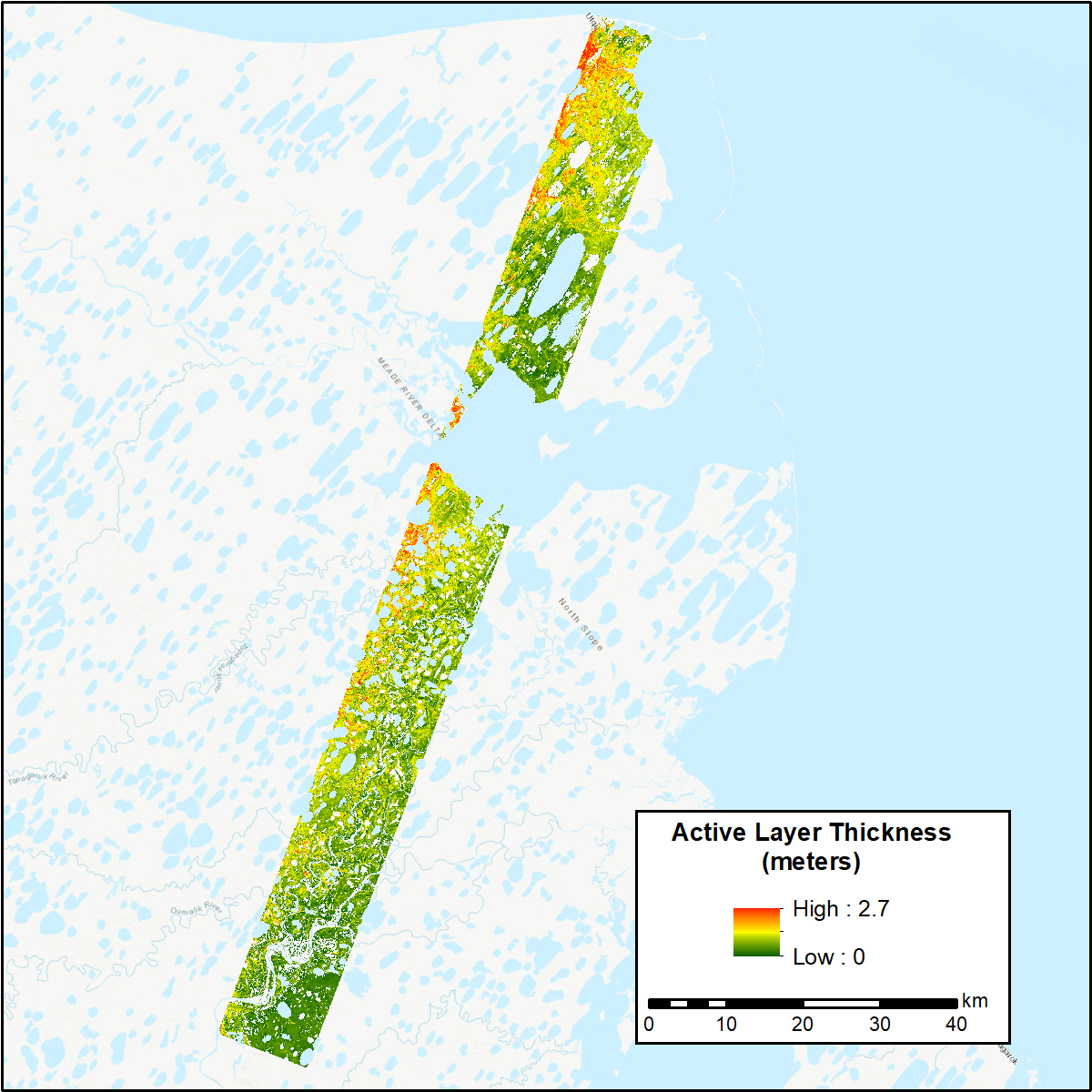
This dataset from the Arctic-Boreal Vulnerability Experiment (ABoVE) provides estimates of soil active layer thickness (ALT) at 30 m resolution for 12 study areas across Northern Alaska. ALT was derived by combining overlapping airborne L-band synthetic aperture radar (SAR) soil seasonal subsidence and P-band SAR soil moisture data through the remotely-sensed active layer thickness (ReSALT) algorithm. The airborne data were collected from 2017-06-19 to 2017-09-16. The L-band soil seasonal subsidence, the P-band soil dielectric constant and volumetric water content, and the calculated uncertainties for all variables are also provided.
ABoVE is a NASA Terrestrial Ecology Program field campaign that will take place in Alaska and western Canada between 2016 and 2021. Research for ABoVE will link field-based, process-level studies with geospatial data products derived from airborne and satellite sensors, providing a foundation for improving the analysis, and modeling capabilities needed to understand and predict ecosystem responses and societal implications. See all ABoVE data at ORNL DAAC.
Data Citation: Schaefer, K., R.J. Michaelides, R.H. Chen, T. Sullivan, A.D. Parsekian, K. Bakian-dogaheh, A. Tabatabaeenejad, M. Moghaddam, J. Chen, A.C. Chen, L. Liu, and H.A. Zebker. 2019. ABoVE: Active Layer Thickness Derived from Airborne L- and P-band SAR, Alaska, 2017. ORNL DAAC, Oak Ridge, Tennessee, USA. https://doi.org/10.3334/ORNLDAAC/1676
Data Center: ORNL DAAC
Sponsor: EOSDIS
