
ABoVE: Distribution Maps of Wildland Fire Fuel Components across Alaskan Tundra, 2015
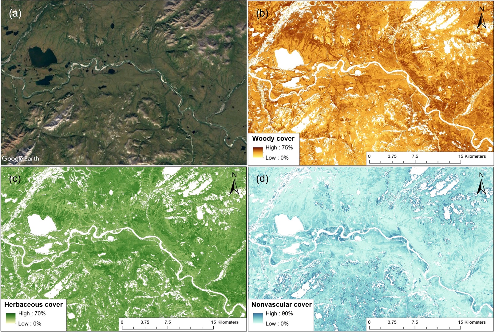
This dataset from the Arctic-Boreal Vulnerability Experiment (ABoVE) provides maps of three major wildland fire fuel types at 30 m spatial resolution covering the Alaskan arctic tundra, circa 2015. The three fuel components include woody (evergreen and deciduous shrubs), herbaceous (sedges and grasses), and nonvascular species (mosses and lichens). Spectral information from Landsat mosaics were combined with field observations from representative tundra vegetation plots collected during multiple field trips to model the fractional cover of fuel type components. These maps and their periodic updates can create a strong basis for enhancing modeling capabilities for both assessing fire behavior and post-fire ecological impacts. The long-term archive of moderate resolution data offers an opportunity to examine the fuel composition change in Alaskan tundra as a result of climate change and fire occurrence.
ABoVE is a NASA Terrestrial Ecology Program field campaign conducted in Alaska and western Canada between 2016 and 2021. Research for ABoVE links field-based, process-level studies with geospatial data products derived from airborne and satellite sensors, providing a foundation for improving the analysis, and modeling capabilities needed to understand and predict ecosystem responses to, and societal implications of, climate change in the Arctic and Boreal regions. See all ORNL DAAC data from ABoVE.
Data Citation: He, J., T.V. Loboda, L. Jenkins, and D. Chen. 2019. ABoVE: Distribution Maps of Wildland Fire Fuel Components across Alaskan Tundra, 2015. ORNL DAAC, Oak Ridge, Tennessee, USA. https://doi.org/10.3334/ORNLDAAC/1761
Data Center: ORNL DAAC
Sponsor: EOSDIS
