
Pre-Delta-X: Water Levels across Wax Lake Outlet, Atchafalaya Basin, LA, USA, 2016
Pre-Delta-X: River Discharge Channel Surveys across Atchafalaya Basin, LA, USA, 2016
These datasets provide absolute water level elevations and river discharge at selected locations across the Atchafalaya Basin, in Southern Louisiana. Field measurements were made during the Pre-Delta-X campaign in October 2016.
For the Water Levels dataset, relative water level measurements were recorded every five minutes during a one-week period using in situ pressure transducers (Solinst) to measure water surface elevation change with millimeter accuracy. The Solinst system combines a total pressure transducer (TPT) and a temperature detector. Once underwater, the TPT measures the sum of the atmosphere and water pressure above the sensor. Atmospheric pressure fluctuations must be accounted for to obtain the height of the water column above the TPT. An absolute elevation correction was applied to the water level data using an iterative approach with the USGS Calumet Station water level height and Airborne Snow Observatory (ASO) lidar water level profiles. These Pre-Delta-X water level measurements served to calibrate and validate the campaign's remote sensing observations and hydrodynamic models.
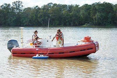
For the River Discharge dataset, measurements were made during the Pre-Delta-X campaign on October 15 to 20, 2016. Seventy-five channel surveys were conducted with a SonTek RiverSurveyor M9 acoustic doppler current profiler (ADCP) on selected wide channels (~100 m) and a few selected (~10 m) narrow channels. ADCP data provide near-instantaneous estimates of river discharge across the sampled channels. Sites coincided with AirSWOT swaths in the Atchafalaya River Basin and water level measurement locations. This in situ dataset was used to calibrate and validate Delta-X hydrodynamic models.
The Delta-X mission is a 5-year NASA Earth Venture Suborbital-3 mission to study the dynamic Mississippi River Delta in the United States. River deltas and their wetlands are drowning as a result of sea level rise and reduced sediment inputs. The Delta-X mission will estimate which areas will survive and continue to grow, and which will be lost. Delta-X begins with airborne and in situ data acquisition and carries through data analysis, model integration, and validation to predict the extent and spatial patterns of future deltaic land loss or gain.
Other data from this mission can be found at the ORNL DAAC's Delta-X project page.
Data Citations:
- Simard, M., M.W. Denbina, D.J. Jensen, and R. Lane. 2020. Pre-Delta-X: Water Levels across Wax Lake Outlet, Atchafalaya Basin, LA, USA, 2016. ORNL DAAC, Oak Ridge, Tennessee, USA. https://doi.org/10.3334/ORNLDAAC/1801
- Christensen, A.I., T.M. Pavelsky, D.J. Jensen, and K. Liu. 2020. Pre-Delta-X: River Discharge Channel Surveys across Atchafalaya Basin, LA, USA, 2016. ORNL DAAC, Oak Ridge, Tennessee, USA. https://doi.org/10.3334/ORNLDAAC/1806